Severe Thunderstorm With Half-Dollar Size Hail Near Ider Moving Toward Bridgeport
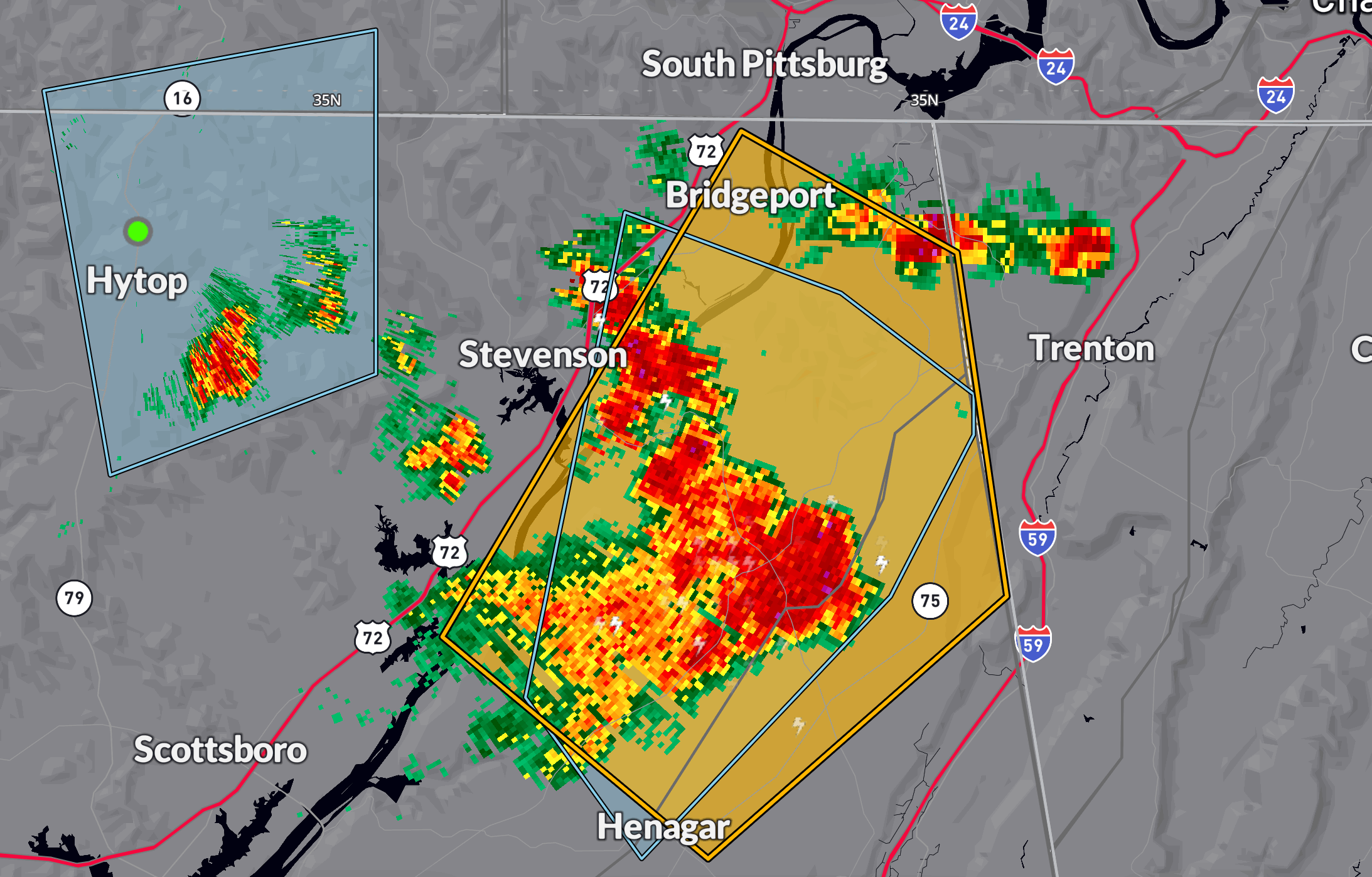
A severe thunderstorm warning has been issued until 5:15 PM CDT for northeastern Jackson and DeKalb counties in Alabama. As of 4:47 PM, a strong storm was located near Ider—about 11 miles south of Bridgeport—moving northeast at 15 mph.
This storm is capable of producing 60 mph wind gusts and half-dollar size hail (1.25 inches). Impacts may include hail damage to vehicles and wind damage to roofs, siding, and trees.
Communities in the path include Bridgeport, Henagar, Ider, Pisgah, Rosalie, Fabius, and Higdon.
If you are in the warning area, seek shelter immediately in a sturdy structure and stay away from windows. This storm could intensify or cause flash flooding in areas with poor drainage.
Category: Alabama's Weather, ALL POSTS, Severe Weather, Social Media
About the Author (Author Profile)
Bill Murray is the President of The Weather Factory. He is the site's official weather historian and a weekend forecaster. He also anchors the site's severe weather coverage. Bill Murray is the proud holder of National Weather Association Digital Seal #0001 @wxhistorianSubscribe
If you enjoyed this article, subscribe to receive more just like it.


