Midday Nowcast: Plenty of Humidity Will Allow for More Rain and Storms Later Today
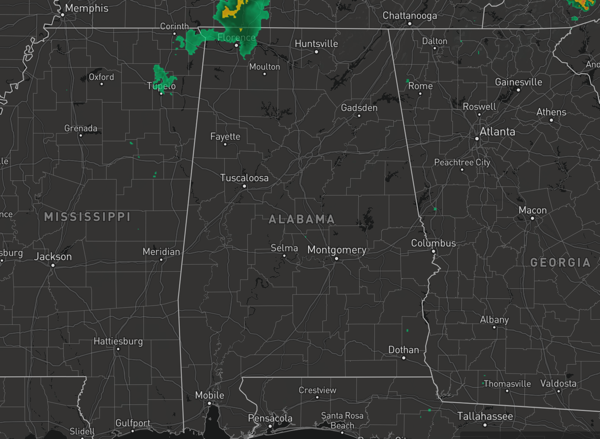
HEAT AND STORMS: Heat Advisories continue today for portions of Alabama as heat index values surge above 105°. Along with the heat, we have to deal with the threat of strong to severe storms due to the high instability values across the state.
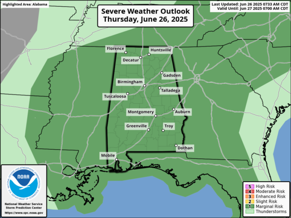
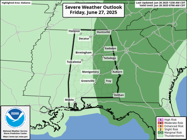
The Storm Prediction Center has much of Alabama in a “marginal risk” (level 1 of 5) for severe weather both today and tomorrow.
Where afternoon and evening storms develop they will likely produce strong, gusty winds and hail. Of course, all summer storms produce frequent and dangerous lightning (WHEN THUNDER ROARS, HEAD INDOORS), along with intense, tropical downpours, which can lead to areas of isolated flash flooding (TURN AROUND, DONT’ DROWN).
BIRMINGHAM ALMANAC: For June 26th, the average high for Birmingham is 90° and the average low is 71°. The record high is 101° set in 2024, while the record low is 50° set in 1974. We average 0.16” of precipitation on this date and the record value is 1.68” set in 2001.
TOMORROW AND THE WEEKEND: The strong upper ridge will weaken and this opens for door for an increase in the number of afternoon/evening showers and thunderstorms, and slightly lower heat levels. Highs will be in the upper 80s and lower 90s. Expect a partly sunny sky with higher rain chances in the 50-60% range. Most of the storms will occur during the afternoon and evening hours.
NEXT WEEK: Temperatures could be a little below average next week with highs in the upper 80s in many areas, otherwise pretty routine summer weather is the story with partly sunny days along with afternoon and evening showers and thunderstorms
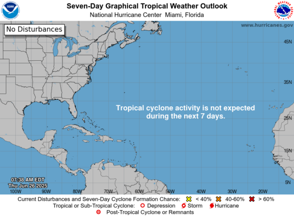
IN THE TROPICS: For the North Atlantic, Caribbean Sea, and the Gulf, tropical cyclone formation is not expected during the next seven days.
WORLD TEMPERATURE EXTREMES: Over the last 24 hours, the highest observation outside the U.S. was 121.3F at Kuwait International Airport, Kuwait. The lowest observation was -95.3F at Concordia, Antarctica.
CONTIGUOUS TEMPERATURE EXTREMES: Over the last 24 hours, the highest observation was 113F at Death Valley, CA. The lowest observation was 23F at Peter Sinks, UT.
Category: Alabama's Weather, ALL POSTS, Social Media
About the Author (Author Profile)
Macon, Georgia Television Chief Meteorologist, Birmingham native, and long time Contributor on AlabamaWX. Stormchaser. I did not choose Weather, it chose Me. College Football Fanatic. @Ryan_StinnetSubscribe
If you enjoyed this article, subscribe to receive more just like it.


