Midday Nowcast: Plenty of Sunshine and Heat for America’s Birthday
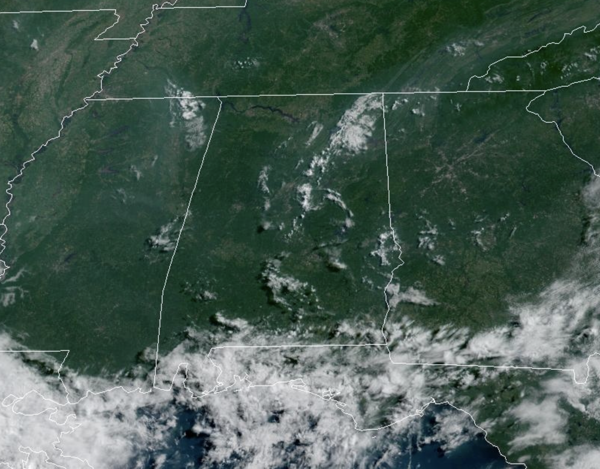
HAPPY 249th BIRTHDAY AMERICA: On this date in 1776, Thomas Jefferson paid for his first thermometer, and signed the Declaration of Independence. According to his weather memorandum book, at 2 PM it was cloudy and 76 degrees in Philadelphia. We are no where near 76° in Alabama today as it is hot and mainly dry. Showers/storms if any, will be few and far between through Sunday. Expect lots of sunshine with highs will be in the low 90s for most places and humidity levels will be down. The chance of thunderstorms through Sunday is not zero, but generally less than 10%. Any and all Independence Day festivities whether grilling out, hitting a body of water to cool off, or fireworks, should not have any weather issues this year. Have fun and be safe!!!
BIRMINGHAM ALMANAC: For July 4th, the average high for Birmingham is 90° and the average low is 71°. The record high is 102° set in 1921, while the record low is 58° set in 1924. We average 0.18” of precipitation on this date and the record value is 3.18” set in 2015.
ACROSS THE GREAT USA: A slight risk of severe weather and excessive rainfall expected today from the northern Plains to the upper Midwest with lingering areas of heavy rainfall possible across western Texas and Florida. Threat of heavy rain increasing for coastal Carolinas as the National Hurricane Center monitors the potential of tropical cyclone development just off the southeast U.S. coast. Heat and humidity will be migrating eastwards across the Great Lakes region towards the East Coast through the Holiday weekend, with notable population centers entering the Major Heat Risk category.
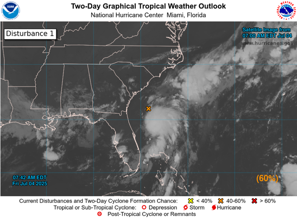
CHANTAL IS THAT YOU?: X marks the spot of the Southeast Coast where we now have Invest-AL92. Showers and thunderstorms have increased in association with an area of low pressure located about 100 miles off the northeast Florida coast. Environmental conditions are forecast to be marginally conducive for further development, and a short-lived tropical or subtropical depression could form late today or on Saturday while the system drifts northward. This low is expected to move inland over the southeastern U.S. Saturday night or early Sunday. Regardless of development, heavy rainfall is possible across portions of west-central and southwestern Florida through early Saturday, and across coastal sections of the Carolinas beginning later on Saturday. In addition, An Air Force Reserve Hurricane Hunter aircraft is scheduled to investigate the system later today. Formation chance through 48 hours…medium…60 percent. Again, the next name up is Chantal. The rest of the Atlantic Basin is quiet.
NEXT WEEK: Moisture levels will rise, and the week will feature very routine summer weather. Partly sunny days with scattered, mostly afternoon and evening showers and thunderstorms. Highs will be close to 90 degrees, which is right where temperatures should be for early July in Alabama. For the second half of next week, showers and storms should become a bit more numerous and widespread in coverage.
WORLD TEMPERATURE EXTREMES: Over the last 24 hours, the highest observation outside the U.S. was 121.3F at Zabol, Iran. The lowest observation was -103.2F at Dome C, Antarctica.
CONTIGUOUS TEMPERATURE EXTREMES: Over the last 24 hours, the highest observation was 113F at Death Valley, CA. The lowest observation was 35F at Redfeather Lakes, CO.
Category: Alabama's Weather, ALL POSTS, Social Media
About the Author (Author Profile)
Macon, Georgia Television Chief Meteorologist, Birmingham native, and long time Contributor on AlabamaWX. Stormchaser. I did not choose Weather, it chose Me. College Football Fanatic. @Ryan_StinnetSubscribe
If you enjoyed this article, subscribe to receive more just like it.


