Showers Remain Isolated; Most Of The Weekend Dry
**No afternoon video briefing today; we are on a holiday schedule**
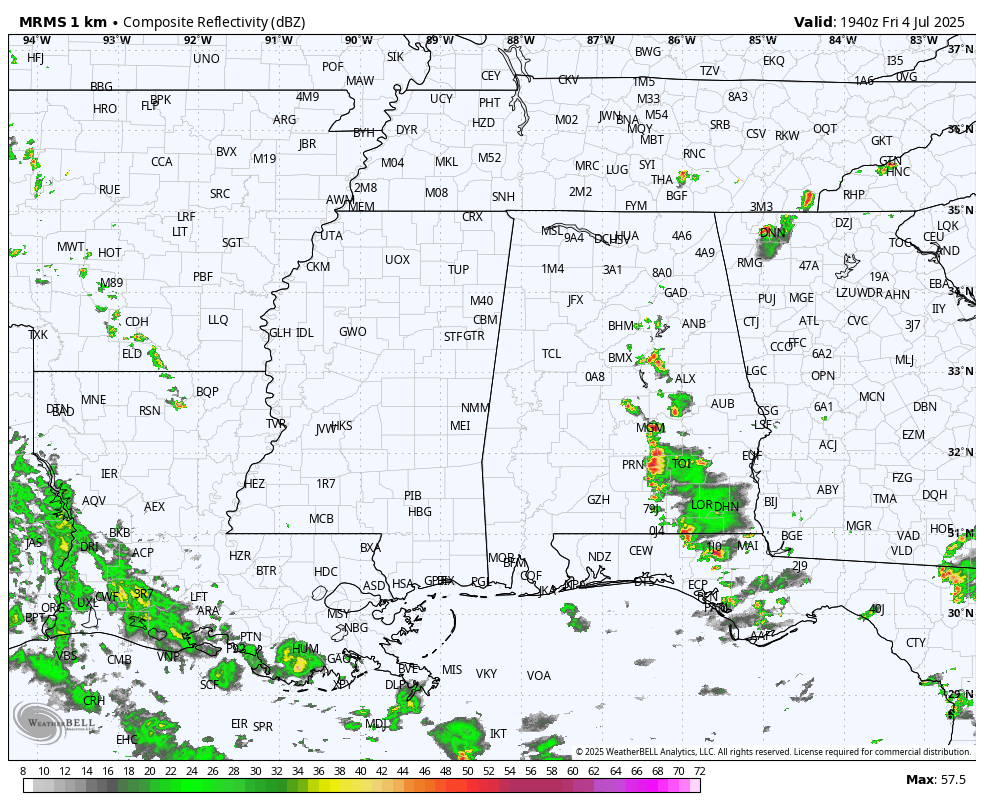
RADAR CHECK: A few isolated showers and storms have formed this afternoon over parts of Central and South Alabama; heavier thunderstorms are over the southern half of the state, and they are moving westward today. The rest of the state is dry with temperatures in the upper 80s and low 90s. Showers and storms will end quickly after sunset.
CALM SUMMER PATTERN: A quiet weather pattern continues across the Deep South through the holiday weekend. Partly sunny days, fair nights, and only isolated afternoon showers. The chance of any one community seeing a shower each afternoon is 10-20 percent, and afternoon highs will be in the 90-95 degree range.
Not much change for at least the first half of next week. Afternoon showers will remain widely spaced, and highs will hold in the low to mid 90s. There could be a slow increase in the number of scattered afternoon showers and storms toward the end of the week, but still no sign of any really widespread rain setup. See the video briefing for maps, graphics, and more details.

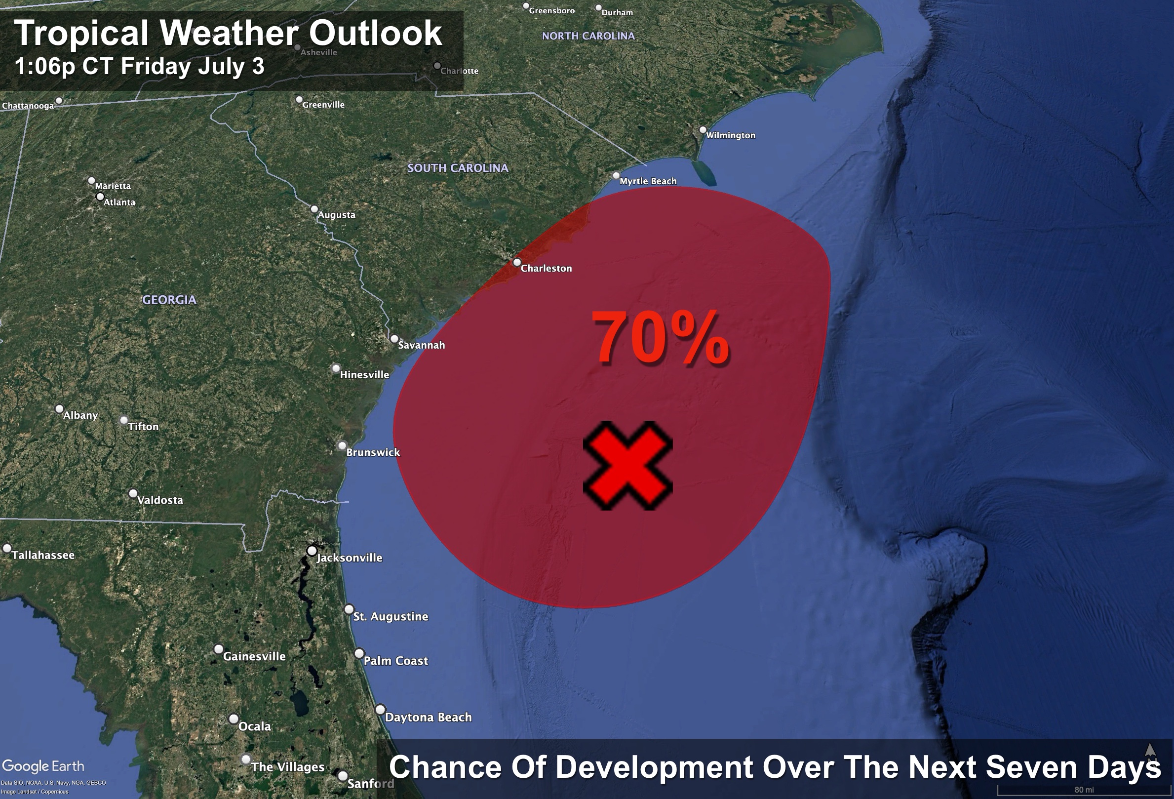
TROPICS: Satellite wind data indicate that the system in the Atlantic located about 150 miles off the northeast Florida coast has become better defined today with an area of strong winds located on its east side. Showers and thunderstorms are also persisting near and to the east of the center.
A short-lived subtropical or tropical depression could form later today or tomorrow while the system drifts generally north-northwestward. This low is expected to move inland over the southeastern U.S. by early Sunday. An Air Force Reserve Hurricane Hunter aircraft is currently en route, and the data they collect should provide more details on the system’s structure. Regardless of development, heavy rainfall is possible across portions of west-central and southwestern Florida through early tomorrow, and across coastal sections of the Carolinas beginning later tomorrow.
NHC gives the system a 70 percent chance of development; the rest of the Atlantic basin (including the Gulf) is very quiet.
ON THIS DATE IN 1911: Record temperatures are set in the northeastern United States as a deadly heat wave hits the area that would go on to kill 380 people. In Nashua, New Hampshire, the mercury peaked at 106 degrees. Other high-temperature records were set all over New England during an 11-day period.
Look for my next video briefing here by 6:00 a.m. Monday… enjoy the weekend!
Category: Alabama's Weather, ALL POSTS, Weather Xtreme Videos
About the Author (Author Profile)
James Spann is one of the most recognized and trusted television meteorologists in the industry. He holds the AMS CCM designation and television seals from the AMS and NWA. He is a past winner of the Broadcast Meteorologist of the Year from both professional organizations.Subscribe
If you enjoyed this article, subscribe to receive more just like it.


