Midday Nowcast: Quiet Radar for Now, But Rain and Storms Will Increase Later Today and Rest of Week
HIGHER RAIN CHANCES: Today through Friday rain chances are higher, in the 50-70% range, meaning scattered to perhaps numerous afternoon and evening showers and storms will be common across the Alabama landscape. Not everyone will see rain, due to the random nature of the storms, but where they occur expects loads of lightning and tropical downpours. These tropical downpours can cause areas of isolated flash flooding. Highs the rest of this week will range from upper 80s to lower 90s. Though organized severe storms are not expected, an isolated severe storm or two is certainly possible any afternoon during the summertime due to the high instability values. The main threats with stronger storms; gusty winds and hail.
BIRMINGHAM ALMANAC: For July 9th, the average high for Birmingham is 91° and the average low is 72°. The record high is 102° set in 1930, while the record low is 55° set in 1947. We average 0.18” of precipitation on this date and the record value is 3.96” set in 1968.
ACROSS THE USA: The Carolinas into the Mid-Atlantic will see the potential for severe weather and flooding rainfall over the next couple of days. Late-day strong to severe thunderstorms and heavy rainfall are expected to impact the northern and central Plains. Storms along a stalling frontal boundary across the Northeast will cool temperatures; the Desert Southwest will be heating up as high temperatures in the range of 110°-118° prompt Extreme Heat Warnings into Thursday.
WEATHER RADAR MAINTENANCE: A reminder the National Weather Service radar in Tuskegee, AL (KMXX) remains offline today for maintenance, but should return to service late today. Later this week, the National Weather Service radar in Calera, AL (KBMX) will be offline for maintenance Friday and Saturday July 11th-12th. Return to service is expected on the 12th. There are several surrounding radar sites available should active weather materialize.
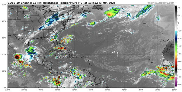
IN THE TROPICS: The Atlantic Basin is quiet, with no tropical cyclone development expected the next seven days this is according to the National Hurricane Center.
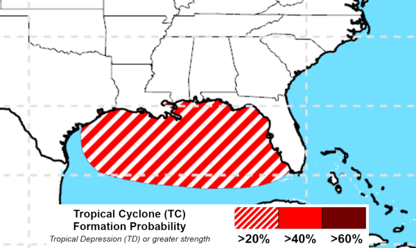
However, I hate to show this, but feel I have too because a bunch of yahoos are posting this on the inter-webs and it is best to head it off. The Climate Prediction Center (CPC) is highlighting a potential area for tropical development in the Gulf, with at least a 20% chance of development in the northern Gulf near the southern U.S. coastline from July 16-22. This is based on the latest long-range outlook, which monitors patterns favorable for tropical development, like increased storminess and warm ocean temperatures. While not an official forecast from the National Hurricane Center, both agencies often collaborate on early indicators of potential development.
WEEKEND WEATHER: No real change as the routine summer pattern continues. Expect partly sunny days, highs in the upper 80s and lower 90s. Each day expect those random, scattered afternoon and evening storms, mainly during the 2pm-10pm timeframe. Rain chances will be in the 40-50% range this weekend. This classic, summertime pattern will persist into next week as we continue through the “Dog Days of Summer.”
WORLD TEMPERATURE EXTREMES: Over the last 24 hours, the highest observation outside the U.S. was 115.9F at Basrah International Airport, Iraq. The lowest observation was -112.4F at Vostok, Antarctica.
CONTIGUOUS TEMPERATURE EXTREMES: Over the last 24 hours, the highest observation was 119F at Stovepipe Wells, CA. The lowest observation was 27F at Peter Sink, UT.
Category: Alabama's Weather, ALL POSTS, Social Media
About the Author (Author Profile)
Macon, Georgia Television Chief Meteorologist, Birmingham native, and long time Contributor on AlabamaWX. Stormchaser. I did not choose Weather, it chose Me. College Football Fanatic. @Ryan_StinnetSubscribe
If you enjoyed this article, subscribe to receive more just like it.


