Rain and Storms Already Cranking Up
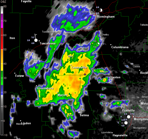
Rain and thunderstorms are already getting started across Central Alabama tonight as a developing upper level system and surface low to our west and southwest gets organized. A warm front will move slowly northward overnight and tomorrow producing periods of rain and thunderstorms.
An area of rain and storms extends from Centreville to Greensboro to Selma. I just saw a lightning stroke show up on lightning detection systems between Centreville and Clanton.
This activity is moving east northeast at 40 mph.
More rain will and storms will occur overnight and tomorrow looks like a rainy, somewhat stormy day. Two to three inches of rain with locally heavier amounts are expected before the rain ends on Tuesday.
(Scroll down for an update on Lexie and Jake, those beautiful missing dogs from Hoover that JB reported on last week.)
Category: Alabama's Weather


