Mississippi Storm Weakening As It Approaches West Alabama

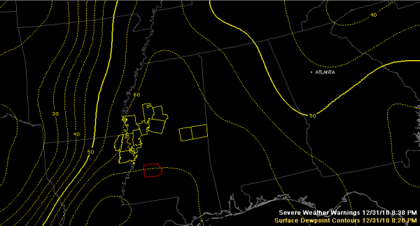
Tornado warning in red, severe thunderstorm warnings in yellow.
So far the really unstable air is having a hard time making it northeast into Alabama.
That’s good.
A strong storm in southern Noxubee and Kemper County in eastern Mississippi has had a severe thunderstorm warning on it, but it appears to be weakening as it approaches southern Pickens Sumter counties in Alabama.
Over Alabama now…moderate rain covers much of the northern third of the state at this hour. Two intensifying storms are over Tuscaloosa and Walker Counties. One is south of Jasper and one is east of Tuscaloosa. These storms are still elevated, meaning that their bases are high off the ground and the thunder can be heard for long distances. John Talbot says he is hearing increasing thunder. Vic Bell reported earlier that he was hearing thunder from a cell that was 40 miles from his location. Bill Lockridge reports lightning and thunder in a special fireworks show courtesy of nature, even though lightning detection systems aren’t picking it up.
MORE TROUBLE BACK TO THE WEST…
Storms are rapidly intensifying over Northwest and West Central Mississippi ahead of the cold front. Several severe thunderstorm warnings are in effect. This main action will swing east overnight and will affect Alabama later on.
In addition, we could see more discrete storms form over Central Mississippi and move into West Alabama. The storm near Hazelhurst has a tornado warning on it, but it appears to be weakening as well.
Category: Uncategorized


