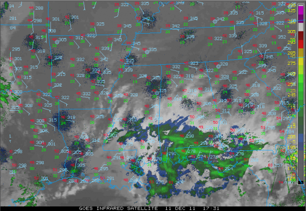
Clouds Thickens, Showers over South Alabama
Most areas saw brilliant sunshine earlier this morning, but our winds are in the process of shifting around to easterly and moisture levels will rise pretty quickly. Clouds have already thickened south or I-20 and will continue quite thick into Monday. The clouds will hold afternoon readings in the lower 50s at best across Central Alabama.
Because of the clouds and increased moisture, lows tonight will be warmer, only dropping to around 40.
Regional radars show showers over South Alabama that have worked their way as far north as Clarke, Monroe and Conecuh counties as of lunchtime and they will continue to work northeastward this afternoon. They are quite light, however, and rain chances will remain small for Central Alabama overnight.
Our winds will gradually shift around to southeasterly over the next couple of days, allowing moisture levels to continue to rise and temperatures to rise as well. The passing disturbance that is bringing the clouds and showers to the area today will continue to do the same tomorrow, with about a 20% chance of showers over western sections, 30% in the middle of the state and 40% across eastern counties. Highs tomorrow will be in the lower and middle 50s.
Tuesday should feature more in the way of sunshine and warmer highs in the 60s. Wednesday will see highs in the middle 60s with a partly cloudy sky. Lows each morning will range between 46-51.
Category: Alabama's Weather


