Wet/Stormy Day
**Brian Peters will have a full discussion and Weather Xtreme video shortly**
PLAN OF THE DAY: I have a pretty busy day today; I am doing a weather program this morning at Brookwood Forest Elementary in Mountain Brook; have a midday speech at the meeting of the Public Relations Council of Alabama (West Alabama/Tuscaloosa chapter), and then tonight at the Greenville Chamber of Commerce annual banquet down in South Alabama. The plan was for me to be away from the TV side today; Brian will be covering the night shift for me. Of course, should severe weather break out, I will cancel and be at the TV station for coverage. We will just take it hour by hour. So it goes in the life of a weather guy. I do my best to caution everyone who asks me to speak.
WHAT WILL HAPPEN TODAY? With the explosion of new followers on Facebook and Twitter this week, and so many questions, I will stick with the FAQ format (frequently asked questions) this morning.
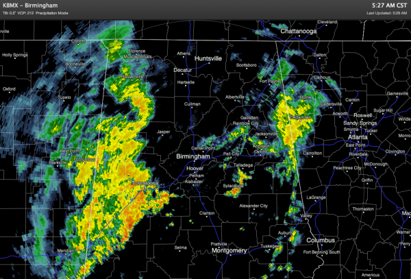
WHAT IS GOING ON NOW? Early this morning, we have lots of rain across the state, but no severe weather issues over the northern half of Alabama… this is the radar shortly before 6:00..
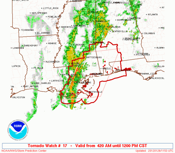
TORNADO WATCH DOWN SOUTH: Here is a tornado watch for Southwest Alabama… valid until noon.
Any severe weather for the next few hours will be confined to that part of Alabama.
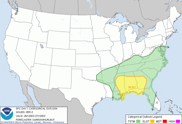
WILL WE HAVE SEVERE WEATHER LATER TODAY? It is possible, but the risk depends on where you are. The greatest risk of severe weather remains over South Alabama, but SPC has pulled the “slight risk” a tad northward:
The “slight risk” is now for about the southern two-thirds of the state, south of a line from Hamilton to Oneonta to Anniston. Of course, storms don’t know where those lines are, that is just a general guideline. Clearly, the better severe weather parameters remain down south, but a few issues can’t be ruled out across North-Central Alabama.
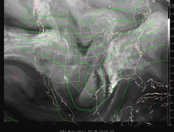
Below is a look at the upper trough approaching Alabama….
Unlike the event Monday morning, this is not a full latitude, negative tilt upper trough; this one is lower in latitude and not as deep. Still, it will bring good dynamic support for rain and storms to Alabama today.
TORNADOES? A few isolated tornadoes are possible in the “slight risk” area, but again the higher risk of an isolated tornado will come over South Alabama, where the instability values are greater. The greater risk will come from gusty winds and hail, however. This risk is not as significant as Monday morning.
WHEN? The greatest risk of severe weather today will come about 12 noon until 9:00 p.m.
FLOODING? The NWS in Huntsville maintains a flash flood watch for their counties up in the Tennessee Valley; most places can expect one to two inches of rain today. I doubt if we have really serious, widespread flooding issues since most of the rain should be gone by midnight. But, if you live in a flood prone area, no doubt the ground is saturated and you need to listen for warnings in the event they are needed.
REMEMBER: When it comes to thunderstorms, expected the unexpected. We will be watching the radar closely today and keep the blog updated with fresh information.
The good news is that tomorrow, Saturday, and Sunday look nice, cool, and dry. Again, Brian will be along shortly with a fresh Weather Xtreme video and forecast details in the longer range. Stay tuned…
Category: Alabama's Weather


