Pretty Nice After All
It’s mostly cloudy and mild across Central Alabama late this morning.
Temperatures are warming quickly through the lower and middle 60s, trying to reach 70F. It could do it in several spots, thanks to a few breaks in the overcast.
Enjoy it while you can this afternoon, because the first few showers were starting to show up west of Montgomery. A few showers and perhaps a couple of thunderstorms will pop up this afternoon.
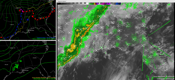
We will continue to watch the line of showers and storms pushing slowly eastward into the state. It will probably get a bit of a second wind as it moves eastward and encounters more warmth, moisture and instability over Alabama. The line will likely become more broken, but it should hold together until after midnight, when it will probably begin to weaken.
It remains to be seen if the stronger instability now over Louisiana and southern Mississippi will be able to advect northeastward into central Alabama. We will be watching in case that happens and a few strong storms might form in areas west of I-65 and south of US-78. The chance is very small. Gusty winds are possible though with any stronger cells.
The SPC does not even have a slight risk of severe weather posted in its late morning outlook. But we will be watching.
The line should weaken to a few light showers over East Alabama by 3 a.m. or so and quietly exit into Georgia before dawn. Overnight lows will be in the middle 50s.
Category: Alabama's Weather


