Showers Pushing East, No Storms Yet
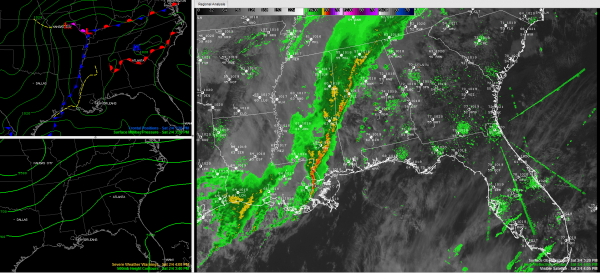
A 70-90 mile wide band of moderate to heavy showers extends in a northeast to southwest orientation across Alabama this afternoon. The leading edge extends from Jackson and Marshall Counties through Cullman, Walker, Tuscaloosa, Greene and Sumter Counties. The line narrows as it extends into Mississippi.
The heavy showers are just arriving in Tuscaloosa.
Ron Hughes in Coker reports rain falling at over ten inches per hour. Of course, that heavy rainfall rate won’t last for very long, maybe 5-10 minutes, but moderate rain will continue for 2 1/2 to 3 hours. He also reports a 25 mph wind gust. No lightning though. Lightning detection shows little or no lightning associated with the activity.
Rainfall amounts with the band so far are generally between one half and one inch. There have been some heavier amounts in eastern Mississippi around Columbus up into Marion County. Muscle Shoals has officially had 0.81 inches and Columbus has had 1.03 inches. Tupelo has picked up 1.59 inches.
The showers will reach western parts of the Birmingham area around 5 p.m., eastern parts between 5:30 and 5:45.
It has been a warm afternoon. Birmingham topped out at 72F, Tuscaloosa 71F and Anniston 72F.
Category: Alabama's Weather


