Last Update
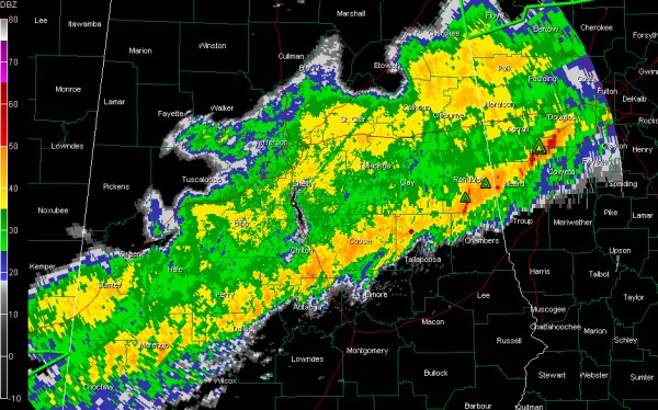
The leading edge of our line of showers and storms extends from Wedowee to Rockford to LInden and Butler.
It is about 60 miles wide.
It is moving southeast at about 20 mph.
The Tornado Watch continues for Autauga, Barbour, Bullock, Chambers, Chilton, Clay, Coosa, Dallas, Elmore, Lee, Lowndes, Macon, Marengo, Montgomery, Perry, Pike, Randolph, Russell and Tallapoosa Counties till 5:00 AM CST.
More counties will be carved from this watch over the next few hours and it eventually might be canceled.
So far 0.72 inches of rain has fallen at the Birmingham Airport as of 1 a.m. The rain is just about over at the Airport, but the forward progress of the line has slowed, so areas south and southeast of Birmingham may see some heavy rain over the next few hours.
Going to pack it in for the night. We will be monitoring conditions in case any additional warnings are required overnight.
Category: Alabama's Weather, Severe Weather


