Strong Storms Forming
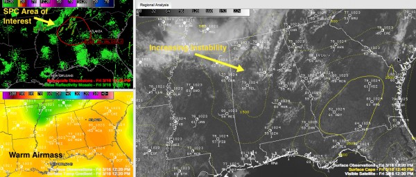
Strong storms are possible this afternoon as an outflow boundary continues to push southeastward into Alabama from an overnight complex of storms to our north that weakened this morning.
The boundary was approaching the I-59 corridor at this hour.
There is a cold airmass aloft behind the boundary, making for unstable conditions.
Storms were refiring across the Tennessee Valley. Storms in southeastern Madison, northern Marshall and Jackson Counties have shown indications of large hail and severe thunderstorm warnings have been issued by the National Weather Service in Huntsville.
A growing storm was approaching Hamilton in Marion County. The NWS Birmingham has issued a significant weather alert, which is the equivalent of a special weather statement, a level below a severe thunderstorm warning.
This is a sign of additional development that will continue through the afternoon with the cold pool aloft and the boundary. Hail and strong gusty winds are likely with the stronger storms. We will see a few more warnings.
The SPC issued a mesoscale discussion a few minutes ago for northern Alabama, southern Tennessee and northwestern Georgia pointing out all this, but saying that with weak shear, widespread severe weather is not expected and a weather watch is not anticipated at this time.
Category: Alabama's Weather, Severe Weather


