The Alabama Weather Situation
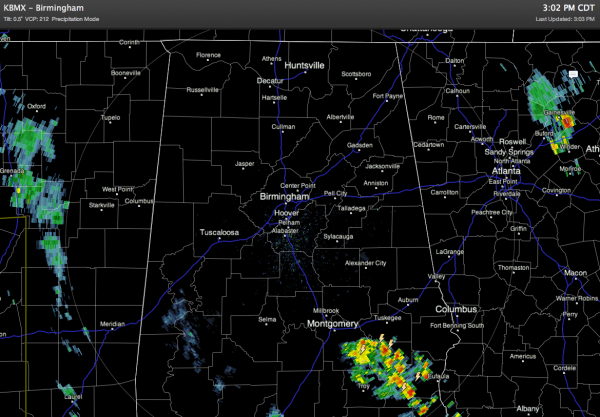
While most of the attention is focused on North Texas and their tornado outbreak this afternoon, we are quiet… below is the radar at 3:02 this afternoon…
THIS AFTERNOON AND TONIGHT: Despite the lack of rain on radar, we will maintain the risk of scattered storms for the rest of this afternoon and tonight as the air is now rather unstable across our state, with surface based CAPEs over 500 j/kg. But, it looks like the most active weather will remain to the west over Mississippi, where a severe thunderstorm watch is in effect for the western part of the state until 10:00 p.m. If storms do form in Alabama, they could be strong, with hail being the main threat.
TOMORROW/THURSDAY: We will maintain a good chance of showers and storms both days. We do NOT expect a major tornado threat here… the main risk with the stronger storms will come from large hail and gusty winds. Most of the storms will come during the afternoon and evening hours, but we can’t rule out the chance of late night or morning rain at times with the upper low getting closer.
FRIDAY: Cooler air moves in… the high drops into the low 70s with only an outside risk of a stray shower.
EASTER WEEKEND: Delightful. Sunny pleasant days, fair cool nights. New guidance is cooler, with highs in the 70s and lows in the 40s.
LONG RANGE: Still evidence even colder air could arrive by the latter half of next week. See the morning Weather Xtreme video for more details.
CONNECT: You can find me on all of the major social networks…
The next Weather Xtreme video will be posted by tomorrow morning at 7:00….
Category: Alabama's Weather


