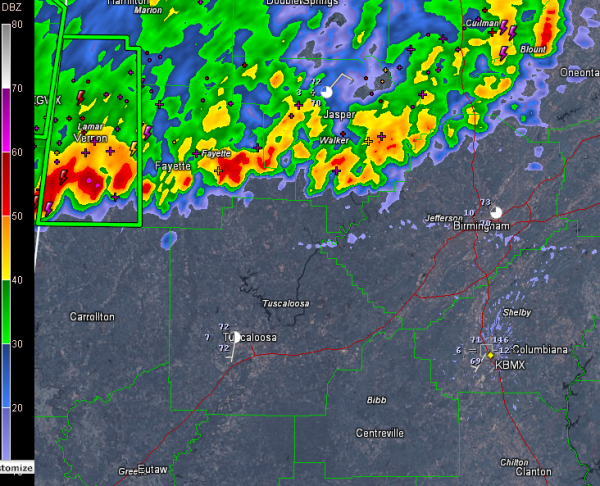
Rain, Storms Approaching I-20 Corridor
Storms continue pushing south southeastward this morning across North Central Alabama from Blount County near Blountsville, now entering northern Jefferson County, then extending across southern Walker, southern Fayette, southern Lamar and about to enter northern Pickens and Tuscaloosa Counties.
There is lightning and thunder and heavy rain all along the line, but the heaviest activity, along with possible small hail is over the western segment from between Millport and Vernon to near Berry to Parrish, Cordova and Sumiton.
The storms look like they will make it at least to a line from Eutaw to Alabaster to Talladega before they run out of steam around 6:30 a.m. The western part of the line will remain the heaviest it appears with lots of lightning and rain and some hail for Pickens and Tuscaloosa Counties.
Moderate to occasionally heavy rain will continue behind the line for an hour or so as well. Could be a morning of welcome rainfall, but headaches for commuters, so allow a little extra time this morning to get where you are going.
Category: Alabama's Weather


