Tropical Update
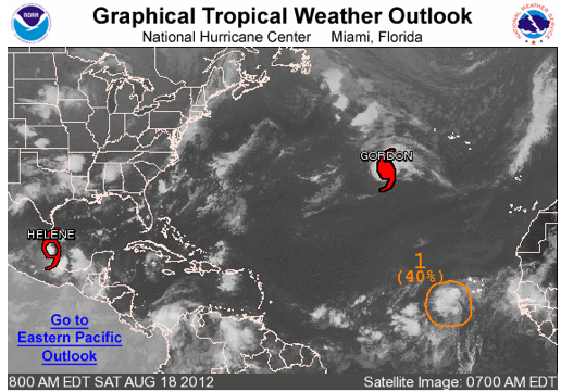
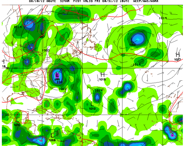
HELENE: Tropical depression seven did manage to become a tropical storm Friday evening, very near the Mexican coast. The system should move completely inland today, bringing heavy rains to the mountainous areas near the coast. We will be keeping an eye on the remnants of Helene, as the GFS has been hinting that the building trough to our west might pick up the energy and the moisture and bring it back northeast toward the Louisiana coast by Tuesday. Of course, if this happens, it could spell a wetter forecast, especially for South Central and South Alabama. That’s not a likely course of events by any means, but just an interesting wrinkle the model threw at us yesterday.
GORDON: Hurricane Gordon is moving eastward over the far North Atlantic. It will weaken a bit as it approaches the Azores on Sunday, probably as a tropical storm. It will reach Europe by midweek.
ISAAC: We are tracking a well defined system southwest of the Cape Verde Islands this morning. The global models indicate that this system will become a tropical storm and perhaps a hurricane before it reaches the islands.. There are increasing indications that it will get into the eastern Caribbean late next week, perhaps affecting the islands of the northeastern Caribbean over the weekend, the moving to off the U.S. East for the Labor Day weekend.
Category: Tropical


