Forecast Changes On Track
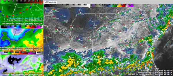
Click the image to enlarge and explore some of the data behind the discussion.
In the last five hours:
The dewpoint at Memphis has dropped from 61F to 54F.
The dewpoint at Tupelo and Muscle Shoals has dropped from 66F to 61F.
At Greenwood, MS it has dropped from 70F to 64F.
Winds have shifted to a northerly direction at all these stations.
Blue skies are starting to show in places like Fayette and Hamilton.
It’s our cold front, and it is making southeastward progress.
A few showers are showing up along the boundary right now. You can find them on radar from north of Tuscaloosa to west of Birmingham, with other over Northeast Alabama near Albertville.
Winds have shifted to westerly at Birmingham. The front will arrive in a few minutes, with the showers and the winds shifting to northwesterly. Then the dwpoints will start dropping. It should feel positively refreshing by sunset.
No signs of any major rain events for Central Alabama tonight or during the morning Monday. But the GFS still maintains that there will be a round of showers and storms over South Alabama Monday afternoon and evening that could reach as far north as the I-20 corridor.
Then drier and sunnier conditions will arrive for the rest of the week.
Category: Alabama's Weather


