Front Edging Closer
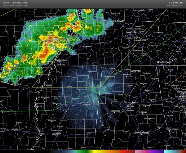
The cold front which has been forecast to make an appearance here tomorrow is edging closer to Central Alabama this evening. The image below shows the thunderstorms just ahead of the front as they were approaching Memphis around 9 pm. A severe thunderstorm watch was in effect until 2 am for portions of northern Mississippi, Tennessee, and Kentucky. Alabama was not included in the watch, but a watch may be possible late tonight and into the early morning hours. Severe weather reported so far has been in the form of hail and damaging wind.
Temperatures drop quickly into the 60s behind the front with dew points in the 50s in northern Missouri and Kansas. Current thinking is that the front should pass Birmingham at or slightly before noon on Saturday bringing an end to the rain threat. Dew points in the 50s should reach the Birmingham area around midnight Saturday night or early Sunday morning. I’m specifying Birmingham as a benchmark, so earlier for areas west and north of Birmingham and later for area east and south of Birmingham.
I plan to have the next Weather Xtreme Video posted by 8 or so in the morning.
-Brian-
Category: Alabama's Weather


