Very Active Pattern
Brian will be along shortly with a full discussion and a fresh Weather Xtreme video. Wanted to address a few issues early this morning…
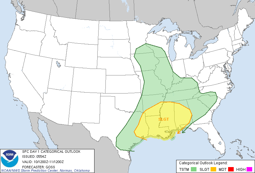
*SEVERE STORMS POSSIBLE TONIGHT: SPC has much of Alabama in the standard “slight risk” of severe weather later today and tonight…
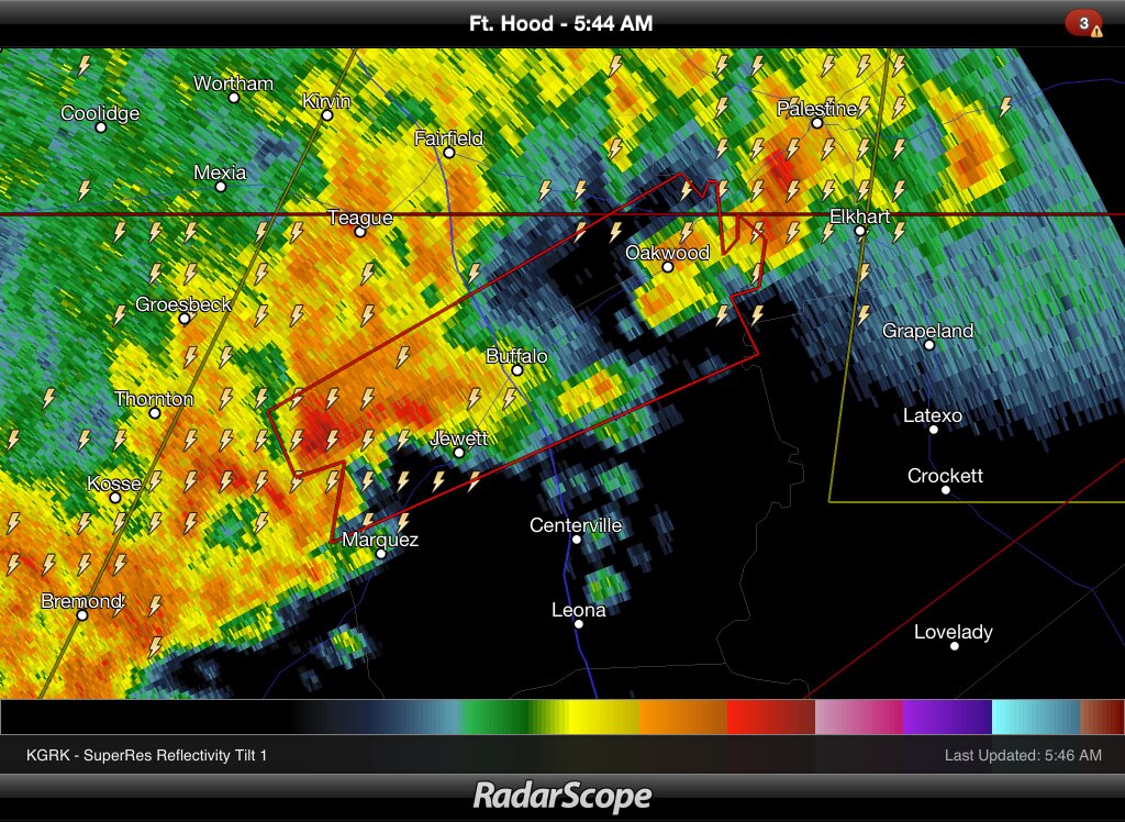
We note severe weather watches are up to the west over parts of TX/OK/LA/AR… here is a tornado warning in effect for parts of Freestone, Limestone, and Leon Counties in TX as I write this early this morning…
Showers are developing over Mississippi this morning, and those will move into West Alabama by midday. Showers will over be over much of Alabama by mid to late afternoon.
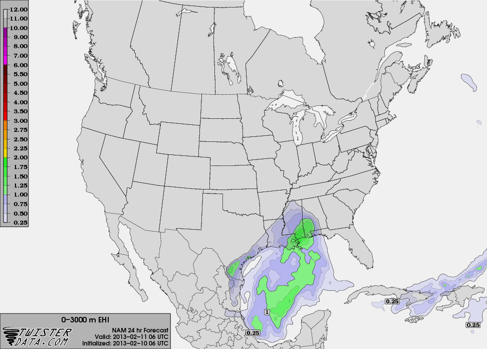
The main window for strong to severe storms will come from about 6:00 p.m. until 3:00 a.m. The highest EHI values are over the southwest part of the state… below is the EHI forecast for midnight tonight (0-3 km)…
The main limiting factor is the lack of instability over the northern half of the state due to warm air aloft. But, it doesn’t take much CAPE for severe storms to form in the cold season, and there is plenty of shear.
The primary threat is from strong, potentially damaging straight line winds, but an isolated tornado can’t be ruled out. And, the main threat will come over the southern half of the state.
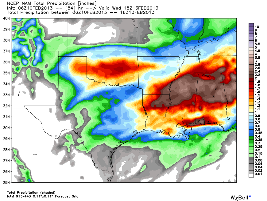
*HEAVY RAIN/FLOODING: During the first round of rain and storms later today and tonight, we project at least one inch of rain for this part of Alabama. We get a break from the rain for a decent part of the day tomorrow, but more rain arrive tomorrow night into Tuesday as another wave of low pressure forms on the stalled front nearby. Most models are printing storm totals of about 2 to 3 inches for the I-20/59 corridors (Birmingham, Anniston, Gadsden, Tuscaloosa). Below is the total precipitation from the NAM model from now through midday Wednesday…
We will be watching the potential flooding issues by Tuesday, Tuesday night, into early Wednesday. Also, river flooding issues could become a problem as well. The NWS in Birmingham and Huntsville has issued a flash flood watch for all of North and Central Alabama.
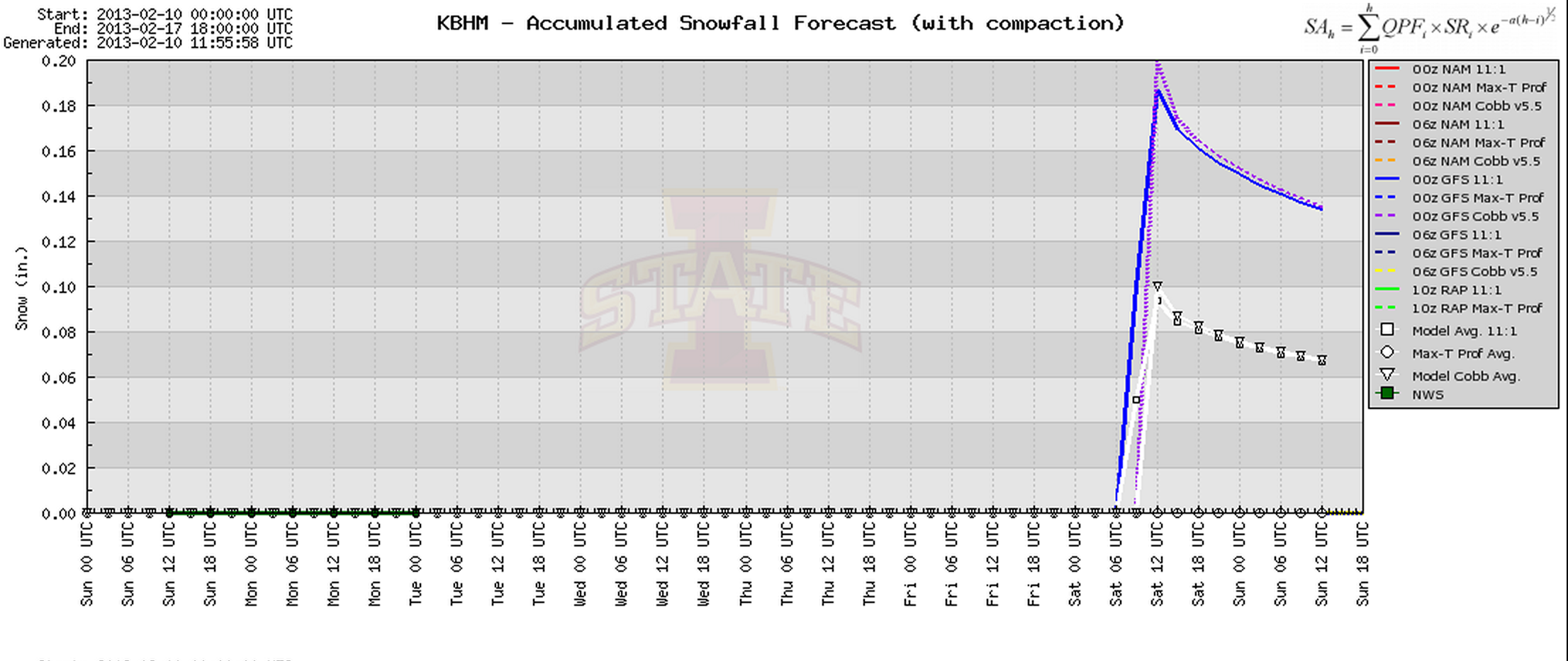
*COLD AIR THIS WEEKEND: Arctic air will invade Alabama this weekend; winter is far from over. Sure looks like we won’t get out of the 30s Saturday with a chilly north wind. And, an impulse (an Alberta Clipper type system) will have the potential to bring a few snow flakes to North Alabama Saturday, but the GFS and the ECWMF show very limited moisture, and not much accumulation…
For now it doesn’t look like much to worry about, but then again it is really early to be confident in a specific forecast. I do think we have a good chance of seeing lows in the 16-20 degree range at daybreak Sunday.
Again, Brian will have a full discussion and a new Weather Xtreme video shortly…
Category: Alabama's Weather
About the Author (Author Profile)
James Spann is one of the most recognized and trusted television meteorologists in the industry. He holds the AMS CCM designation and television seals from the AMS and NWA. He is a past winner of the Broadcast Meteorologist of the Year from both professional organizations.Subscribe
If you enjoyed this article, subscribe to receive more just like it.


