

Strong Storms Impacting West Alabama
Strong, non-severe storms continue to make their way into Alabama.
These storms are producing gusty winds, up to 50mph, heavy rain and frequent cloud to ground lightning. The low-level jet has intensified the last few hours and has allowed more moist air to move in which is providing a little more fuel for the thunderstorms coming into the state.
Hamilton, Sulligent, Vernon, Reform and Pickensville are seeing some rough weather currently. These storms will be impacting Haleyville, Fayette and Gordo within the hour.
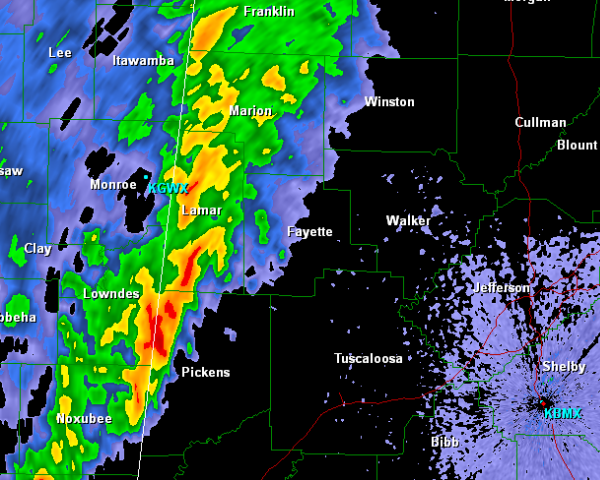
Over the next few hours, there is still a chance for storms to reach severe limits and the main threat being damaging winds, still cannot rule out and isolated tornado either. Storms have intensified over the last hour but remain below severe limits. There are a few bowing and kinking segments along the line and these are the portions of the line we will be keeping a close eye on the next couple of hours.
Category: Alabama's Weather, Severe Weather
About the Author (Author Profile)
Macon, Georgia Television Chief Meteorologist, Birmingham native, and long time Contributor on AlabamaWX. Stormchaser. I did not choose Weather, it chose Me. College Football Fanatic. @Ryan_StinnetSubscribe
If you enjoyed this article, subscribe to receive more just like it.


