Amazing Rains in San Antonio
UPDATED AT 11:45 FOR THE SAN ANTONIO RIVER GRAPHIC AND THE 4 INCH RAINFALL TOTAL BETWEEN 6-7 AM.
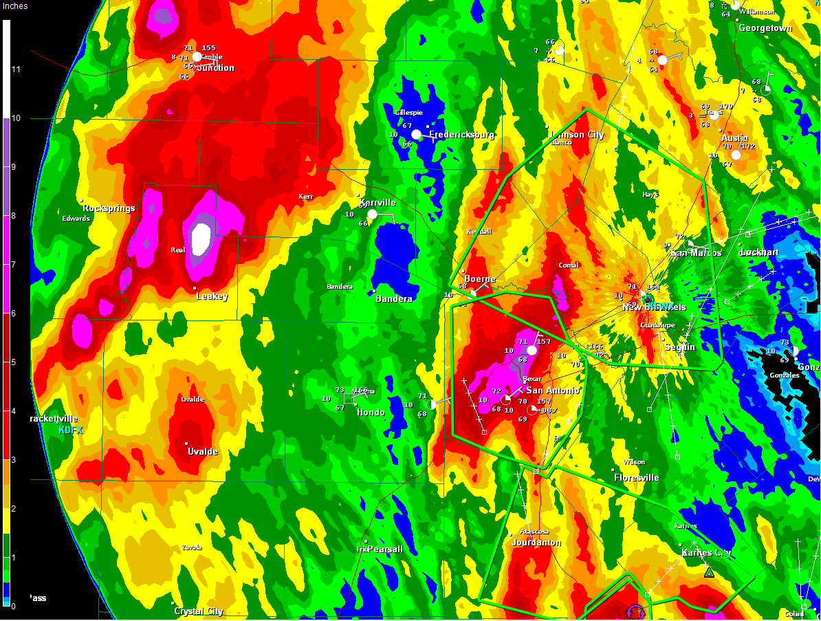
A major, life threatening flash flooding event has been occurring this morning in the San Antonio area as moist, unstable air over the Hill Country combined with an upper level disturbance to produce a significant heavy rainfall event.
Doppler radar estimates show the heavy rainfall totals.
The NWS San Antonio issued a flash flood emergency for the San Antonio Metro early this morning and flash flood warnings continue for the San Antonio area and much of the Hill Country up to San Marcos.
According to the National Weather Service in San Antonio, river rises in the San Antonio Metro area are behaving like flash floods. The San Antonio River reached historical levels at the 410 Loop this morning.
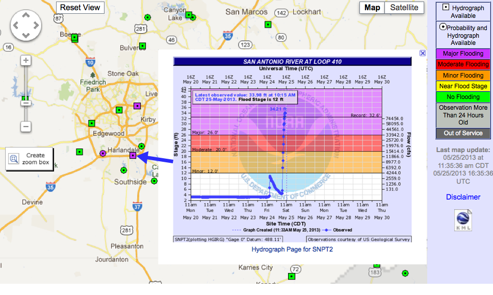
The San Antonio River in downtown overflowed its banks for a short time, but has gone back within its banks.
Fortunately, the heavy rainfall has shifted north and east and drier conditions are expected this afternoon.
12.31 inches of rain had fallen at the San Antonio Airport in the past 31 hours through 11 a.m. Four inches of rain fell between 6 a.m. and 7 a.m., which is probably a record as well.
The 9.86 inches that had fallen today through 11 a.m. was already enough to be the second highest one day total for the city. The all time record is 11.26 set on October 17, 1998.
Category: Headlines
About the Author (Author Profile)
Bill Murray is the President of The Weather Factory. He is the site's official weather historian and a weekend forecaster. He also anchors the site's severe weather coverage. Bill Murray is the proud holder of National Weather Association Digital Seal #0001 @wxhistorianSubscribe
If you enjoyed this article, subscribe to receive more just like it.


