

Showers/Storms Developing
Scattered showers are trying to form on this Father’s Day afternoon across Central Alabama.
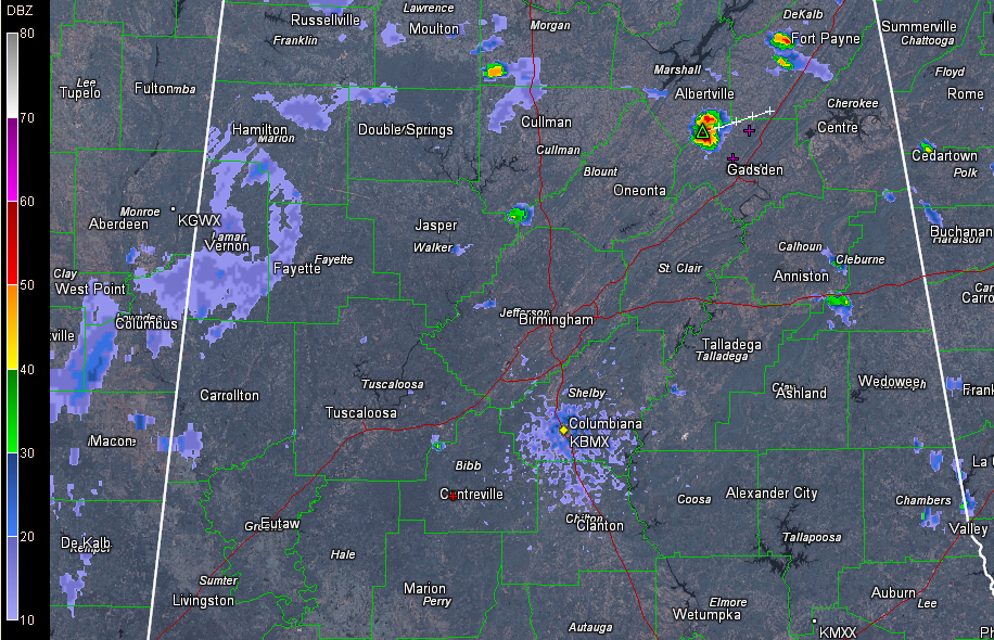
The heaviest one at this hour is on the Marshall/Etowah County line between Albertville and Gadsden. It is approaching US-431 near and south of Boaz. It is producing frequent lightning.
Others were developing southwest of Fort Payne in Northeast Alabama and others were developing along I-20 east of Oxford.
development will be favored in the next couple of hours over West central Alabama as the leading edge of an upper level disturbance helps to spark showers and storms. There has already been at least one lightning strike west of Pickens County in Noxubee County, Mississippi. This cell was approaching Memphis, AL.
Storms shouldn’t be severe today, but they could be strong, with just enough wind shear to keep them from choking on their own downdrafts. Look for brief heavy rain and frequent lightning as well as gusty winds in the heavier cells.
The showers will die out this evening. More widespread showers and storms are expected Monday and Tuesday.
Category: Alabama's Weather
About the Author (Author Profile)
Bill Murray is the President of The Weather Factory. He is the site's official weather historian and a weekend forecaster. He also anchors the site's severe weather coverage. Bill Murray is the proud holder of National Weather Association Digital Seal #0001 @wxhistorianSubscribe
If you enjoyed this article, subscribe to receive more just like it.


