

A Few Isolated Storms
A few isolated thunderstorms continue across Central Alabama this afternoon.
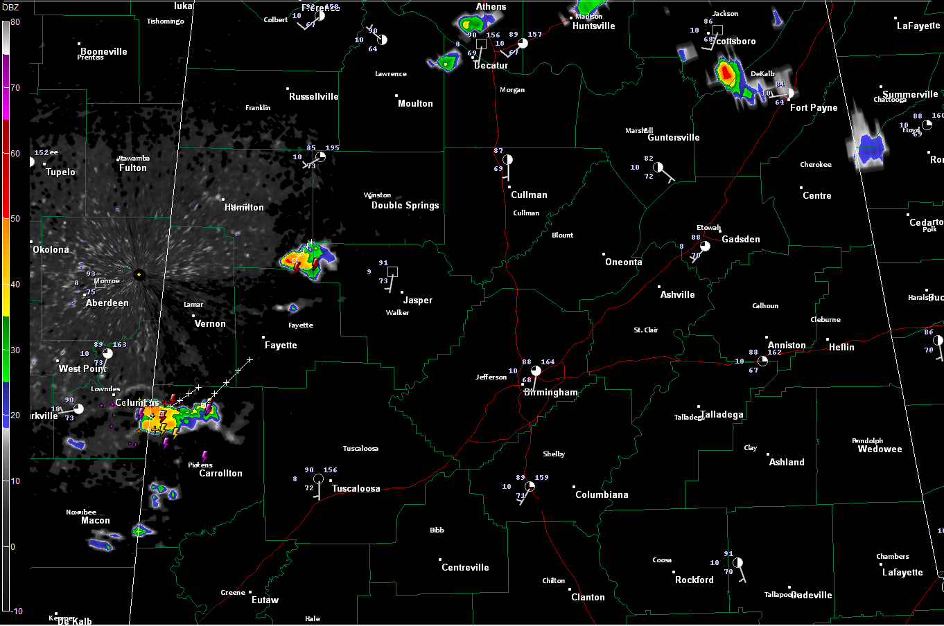
The strongest one was in northern Pickens County crossing US-82 between Columbus MS and Reform. This storm was producing very heavy rain and frequent lightning. It was moving northeast toward Millport and Kennedy in southern Lamar county. This is a favored area for development right now, with showers building back through the southwestern part of Pickens County into Noxubee County MS.
The second strongest cell was between Winfield and Carbon Hill. Another cell was forming southwest of Carbon Hill as well. Heavy rain was falling along old US-78 around Glen Allen.
Other cells were in Northeast Alabama between Section and Fort Payne.
Widely scattered storms will continue to pop up through the remainder of the afternoon and will die down after sunset.
Most everyone will remain dry.
Temperatures are in the upper 80s to lower 90s now across the area.
Category: Alabama's Weather
About the Author (Author Profile)
Bill Murray is the President of The Weather Factory. He is the site's official weather historian and a weekend forecaster. He also anchors the site's severe weather coverage. Bill Murray is the proud holder of National Weather Association Digital Seal #0001 @wxhistorianSubscribe
If you enjoyed this article, subscribe to receive more just like it.


