Strong Storm over Northeast Jefferson
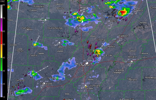
Showers and a few thunderstorms continue across parts of North and Central Alabama this afternoon.
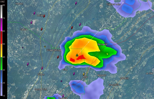
The strongest storm in Central Alabama is over Northeast Jefferson County near Clay. It is producing heavy rain and frequent lightning. It will push into southeastern Blount and northwestern St. Clair Counties passing near and just west of Springville.
Other strong storms are over southern Morgan and northern Cullman Counties along I-65 betwwen Falkville and Vinemont and over Jackson/DeKalb counties in Northeast Alabama.
More storms are over southern Pickens County along the Tombigbee River around Aliceville, north of Gordo/Reform and south of Winfield.
To the west, a weakening area of showers/storms was pushing into western Mississippi between Greenville and Natchez.
The showers should go downhill after sunset, but we could see more showers/storms overnight as the weakening disturbance pushes across the area.
Category: Alabama's Weather


