

Unsettled Summer Weather
**No afternoon Weather Xtreme video today…. I have been at the American Meteorological Society Conference on Broadcast Meteorology in Nashville, and am on the way back home this afternoon. Back to the “two a day” video schedule tomorrow**
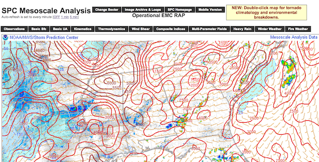
UNSTABLE AIR: We expect more thunderstorm development in the moist, unstable environment across Alabama this afternoon. Seems like the areas west of Birmingham and Tuscaloosa have the best chance of immediate development… this is where surface based CAPE values (instability) have soared to over 5,000 j/kg in spots.
Where storms do form this afternoon and this evening, they will be strong, maybe even severe in spots; the primary threat is from strong straight line winds. And, of course, all summer storms pack an amazing amount of lightning. They will settle down tonight once the sun goes down.
SEVERE STORMS TOMORROW? SPC now has much of Alabama in the standard “slight risk” of severe weather tomorrow…

Colder air aloft associated with an upper trough over the eastern U.S… and an approaching front will set the stage for storms tomorrow with potential for high wind, and maybe even some hail. Best chance of storms will come during the afternoon and nighttime hours; before the storms arrive temperatures will try to reach the mid 90s, making for a very unstable airmass.
THE WEEKEND: The front will stall out somewhere over North Alabama… I think we need to mention at least a chance of scattered showers and storms both Saturday and Sunday, but there will be some good intervals of sunshine. The high both days will be in the upper 80s.
NEXT WEEK: The upper trough over the eastern half of the nation will keep temperatures below average, with highs generally in the mid to upper 80s. And, with a good supply of moisture, each day we will have potential for scattered showers and storms; they could be numerous at times. The most intense heat in the nation will remain well to the west of our state.
GULF COAST WEATHER: About 6 to 8 hours of sunshine each day through Sunday with a few scattered showers or storms each day… next week 3 to 5 hours of sun daily with showers and storms becoming more numerous as tropical moisture levels rise. Highs on the immediate coast will be in the mid to upper 80s, and the sea water temperatures along the coast are in the low to mid 80s.
TROPICS: Tropical storm formation is not expected in the Atlantic basin through the weekend.
WEATHER BRAINS: Don’t forget you can listen to our weekly 90 minute netcast anytime on the web, or on iTunes. This is the show all about weather featuring many familiar voices, including our meteorologists here at ABC 33/40.
CONNECT: You can find me on all of the major social networks…
Facebook
Twitter
Google Plus
Instagram
Look for the next Weather Xtreme video here by 7:00 a.m. tomorrow….
Category: Alabama's Weather
About the Author (Author Profile)
James Spann is one of the most recognized and trusted television meteorologists in the industry. He holds the AMS CCM designation and television seals from the AMS and NWA. He is a past winner of the Broadcast Meteorologist of the Year from both professional organizations.Subscribe
If you enjoyed this article, subscribe to receive more just like it.


