

Still Watching for Thunderstorm Development
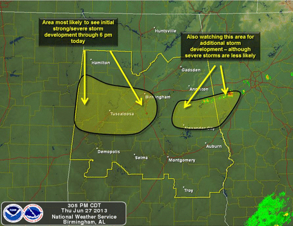
A very unstable air mass remains in place across Alabama this afternoon. Showers and thunderstorms can develop rapidly with the amount of CAPE across the state. CAPE values are greater than 5000 J/kg in many areas and that will provide the fuel for strong and severe storms if they can develop. There is a capping inversion in place, but daytime heating is slowly eroding it away. If storms develop, they will do so quickly and the main severe weather threats will be very large hail and damaging winds. We will have to watch for some isolated flash flooding as well and of course dangerous and frequent lightning will accompany any storms that develop. Storms that develop will move off to south-southeast rapidly this evening. Here is a great graphic put together by the folks at the NWS on what is expected the rest of the afternoon.
Category: Alabama's Weather, Severe Weather
About the Author (Author Profile)
Macon, Georgia Television Chief Meteorologist, Birmingham native, and long time Contributor on AlabamaWX. Stormchaser. I did not choose Weather, it chose Me. College Football Fanatic. @Ryan_StinnetSubscribe
If you enjoyed this article, subscribe to receive more just like it.


