

Early Evening Radar Check
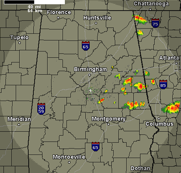
A quick look at the radar this evening shows that showers and thunderstorms have developed across portions of East Alabama. The storms that have developed are not currently severe and should remain below severe limits. We will have to keep and eye on them as they could pulse up and reach severe limits briefly with the chance to produce hail and damaging winds. These storms are producing very intense rain and frequent lightning and are pushing off to the south very rapidly. The most intense activity is currently affecting portions of Randolph, Clay, Tallapoosa and Chambers Counties. Future development should remain south of Interstate 20 for the rest of the evening. Storms continue to remain a threat this evening and are likely to develop until the sun sets. Once the sun sets, storms should begin to wind down with the loss of daytime heating.
Tomorrow we are looking for a more widespread threat for some organized severe weather. A front will be moving south through Alabama and will provide enough uplift for the very warm and unstable air mass in place. The SPC has much of Alabama included in their standard slight risk for severe weather. Storms will be capable of producing large hail, damaging winds and torrential rains.
Category: Alabama's Weather
About the Author (Author Profile)
Macon, Georgia Television Chief Meteorologist, Birmingham native, and long time Contributor on AlabamaWX. Stormchaser. I did not choose Weather, it chose Me. College Football Fanatic. @Ryan_StinnetSubscribe
If you enjoyed this article, subscribe to receive more just like it.


