Afternoon Radar Check
Late this morning, showers and storms began to develop across the Alabama landscape. As we continue to head through the afternoon, these showers and storms have continued to develop.
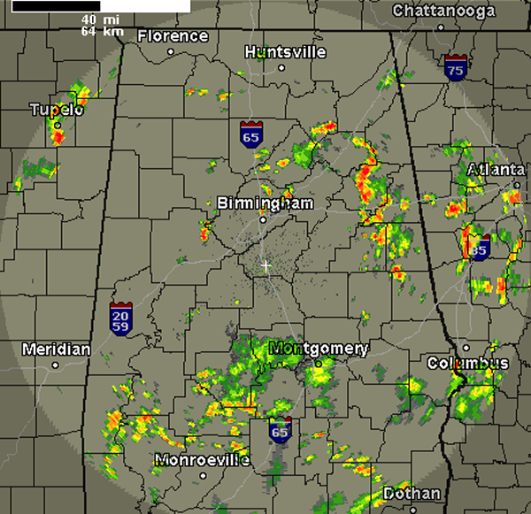
The most intense activity has been across East Alabama today, affecting portions of Etowah, Calhoun, Cleberne, Clay, Chambers and Randolph Counties. The last few radar scan shows an intense storm developing over northeastern Tuscaloosa County as well.
Storms today will be producing tremendous amounts of lightning and very loud thunder. Heavy rain, gusty winds and hail could occur as well. Storm movement is towards the north today.
These storms are producing very tall cloud tops as there are strong updrafts associated with these storms today. If you are lucky enough to be caught under one of these storms, you will receive a bit of heat relief. If you are not be impacting by storms yet, it is a mostly sunny, hot and humid Saturday afternoon across Alabama.
Category: Alabama's Weather
About the Author (Author Profile)
Macon, Georgia Television Chief Meteorologist, Birmingham native, and long time Contributor on AlabamaWX. Stormchaser. I did not choose Weather, it chose Me. College Football Fanatic. @Ryan_StinnetSubscribe
If you enjoyed this article, subscribe to receive more just like it.


