

Intense Storms and Flooding
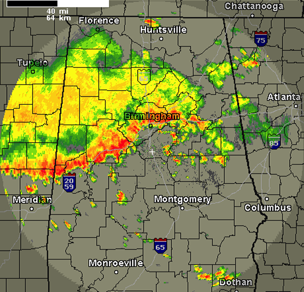
A line of very intense storms have made their way into Birmingham and Tuscaloosa. These intense storms are along Interstate 20 from Eutaw to Lincoln and are continuing to drop to the southeast. These storms are just below severe limits but have a history of producing damage. Our main concern remains the threat for flooding.
In 21 minutes at the Birmingham Airport, over six tenths of an inch had fallen and was still coming down hard.
A peak wind gust of 40mph was recorded at both the Tuscaloosa and Birmingham Airports as these storms rolled through.
Numerous trees have been reported down in in West Alabama. A report of a tree down on Morris Majestic Road in northern Jefferson County.
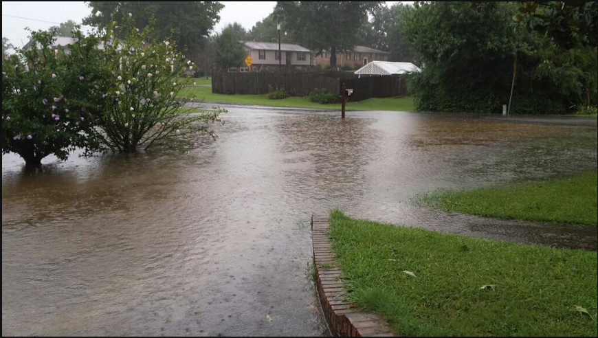
This picture from Leah Hudson via Twitter @vivalaleah from Warrior, Alabama in the Cherokee estates neighborhood.
Category: Alabama's Weather
About the Author (Author Profile)
Macon, Georgia Television Chief Meteorologist, Birmingham native, and long time Contributor on AlabamaWX. Stormchaser. I did not choose Weather, it chose Me. College Football Fanatic. @Ryan_StinnetSubscribe
If you enjoyed this article, subscribe to receive more just like it.


