Late Morning Update on Dorian
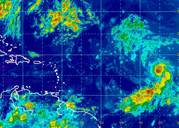
Dorian continues to spin and head west-northwest across the Central Tropical Atlantic. Overnight he did intensify as his pressure lowered and winds increased, but since the early morning advisory, intensity has not changed.
Latest specifics on Dorian:
SUMMARY OF 1100 AM AST…1500 UTC…INFORMATION
———————————————–
LOCATION…16.0N 35.9W
ABOUT 1800 MI…2900 KM E OF THE NORTHERN LEEWARD ISLANDS
MAXIMUM SUSTAINED WINDS…60 MPH…95 KM/H
PRESENT MOVEMENT…WNW OR 285 DEGREES AT 17 MPH…28 KM/H
MINIMUM CENTRAL PRESSURE…999 MB…29.50 INCHES
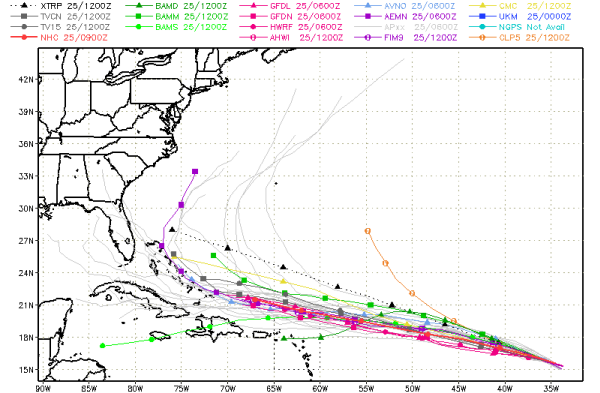
As he continues his track, the models are in pretty good agreement that Dorian maintains a fairly consistent track into next week. It looks as though Dorian should stay north of the Antilles, but could be close enough to certainly impact the islands later this weekend and into next week. Long range model tracks are a bit more inconsistent. Some show Dorian beginning to curve to the north, where it would hopefully miss the U.S. Mainland, others continue a more westward track. We still have plenty of time to watch this system.
Category: Alabama's Weather, Tropical
About the Author (Author Profile)
Macon, Georgia Television Chief Meteorologist, Birmingham native, and long time Contributor on AlabamaWX. Stormchaser. I did not choose Weather, it chose Me. College Football Fanatic. @Ryan_StinnetSubscribe
If you enjoyed this article, subscribe to receive more just like it.


