

Front Dropping into Alabama Overnight
Saturday has been a mostly humid day across much of the state. Very isolated showers developed over portions of West Alabama today and these storms pulsed up quickly and pulsed down just as quick. Still seeing a few showers over portions of Tuscaloosa and Fayette Counties this evening. The more intense activity today has been confined to the southern third of the state.
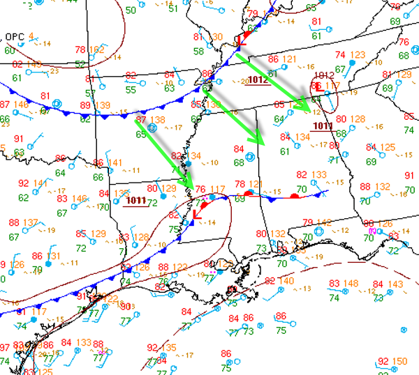
As we head into the overnight hours, a front will be dropping into Alabama and will be bringing in drier air.The front is just now making it into the Memphis area of western Tennessee. Temperature difference across the front is not too noticeable, but the dew points will certainly decrease as the front passes. Dew points across Alabama currently are in the 60s and 70s. Behind the front, dew points are in the low 50s into Missouri. That air is heading our way and it means less humid and more comfortable conditions for Sunday and Monday.
Sunday will have mostly sunny skies and a great looking afternoon. Highs should make it into the mid 80s in most locations. Tomorrow night will have terrific weather; clear skies and drier air will allow for temperatures to drop into the lower and mid 60s for most locations. Some 50s could certainly sneak in to some of those cooler spots in northern Alabama. Very nice weather for late July.
Category: Alabama's Weather
About the Author (Author Profile)
Macon, Georgia Television Chief Meteorologist, Birmingham native, and long time Contributor on AlabamaWX. Stormchaser. I did not choose Weather, it chose Me. College Football Fanatic. @Ryan_StinnetSubscribe
If you enjoyed this article, subscribe to receive more just like it.


