Showers and Storms Scarce For Now
Alabama in awash in a sea of cotton balls today as a nice field of cumulus clouds lies across the state thanks to ample moisture and heating.
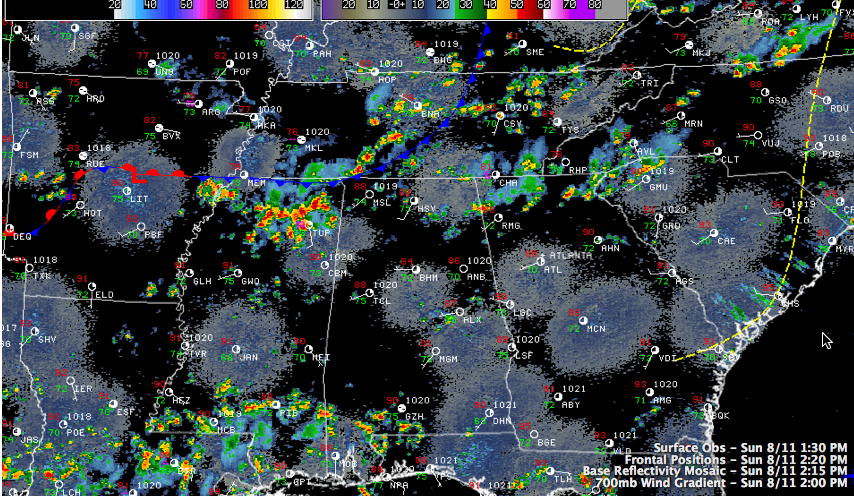
Showers and storms have not gotten a real foothold yet, despite temperatures that were quickly approaching 90F at 2 p.m.
Instability values are sufficient for storms. What convective inhibition might have been present this morning is gone. The airmass overall may be a little drier over all but northwestern sections I guess. Somewhere in there may lie an explanation about the relative absence of storms for now.
A flurry of showers formed an hour or so ago over Chilton, Coosa and Tallapoosa Counties, but they have since fallen apart for the most part.
It is a different story over northern Mississippi, extreme northwestern Alabama into southern Tennessee. A frontal system lies from near Little Rock to Memphis to Nashville, generally along I-40. A very weak surface low rippling along the front is triggering widespread showers and storms across northern Mississippi. These storms could translate into Northwest Alabama as the low plods eastward.
Elsewhere, scattered storms will be the rule through the afternoon and evening hours. If you are lucky enough to get under one of these cooling showers, you could see heavy rain as well as frequent lightning.
Category: Alabama's Weather
About the Author (Author Profile)
Bill Murray is the President of The Weather Factory. He is the site's official weather historian and a weekend forecaster. He also anchors the site's severe weather coverage. Bill Murray is the proud holder of National Weather Association Digital Seal #0001 @wxhistorianSubscribe
If you enjoyed this article, subscribe to receive more just like it.


