Two Interests in the Tropics
The latest look at the tropics still shows that we have two areas we are watching.
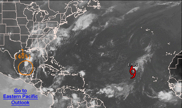
The first is in the eastern Atlantic, where Tropical Storm Erin remains a weak system. Winds are sustained at 40mph and she continues to move off towards the northwest. Erin will have a hard time strengthening as the system will be interacting with dry air and an unfavorable environment.
Closer to Alabama, an area of disturbed weather continues to move west-northwest across the southern Gulf of Mexico. It remains disorganized as most of the convection associated with it remains off to the north-northeast of the center of circulation. This system is sending ample moisture north towards the Gulf Coast and is making it anything but a nice weekend along the beaches. Flooding remains a major concern in these areas. The NHC gives the system a 40% chance of developing into a tropical cyclone the next 48 hours. It is expect to continue to move towards the lower Texas or Mexican Gulf Coast over the weekend.
Category: Tropical
About the Author (Author Profile)
Macon, Georgia Television Chief Meteorologist, Birmingham native, and long time Contributor on AlabamaWX. Stormchaser. I did not choose Weather, it chose Me. College Football Fanatic. @Ryan_StinnetSubscribe
If you enjoyed this article, subscribe to receive more just like it.


