

Scattered Summer Storms
**No afternoon Weather Xtreme video today due to travel**
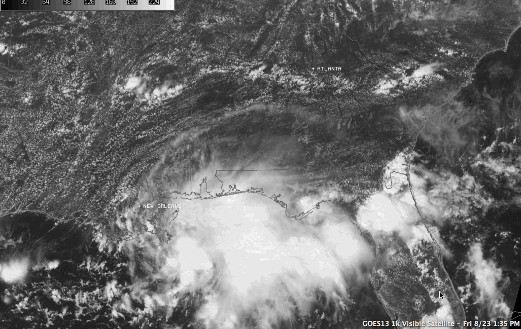
Nice visible satellite loop today… showing a disturbance in the Gulf of Mexico moving west, and scattered convective storms forming over Alabama…
Storms today are moving south at 10-20 mph, and the heavier ones are producing torrential rain and lots of lightning. They will settle down tonight once the sun goes down.
WEEKEND OUTLOOK: Not much change in the thinking; hot and humid with partly sunny days, and afternoon highs around 90. A few storms are likely, but they should be widely scattered, and mostly during the afternoon and evening hours.
The first half of next week looks pretty dry with mostly sunny days, fair nights, and only isolated showers and thunderstorms. Highs will be in the 88-91 degree range. Moisture levels will begin to rise toward the end of the week, however…
TROPICS: The broad system in the northern Gulf is moving west, and NHC is not expecting it to becoming a tropical depression or storm; they list only a 10 percent risk. Elsewhere, the tropics are quiet.
GULF COAST WEEKEND WEATHER: The mass of storms in the northern Gulf is skirting the coast this afternoon, and over the weekend we are now projecting 3-5 hours of sunshine tomorrow and Sunday with a few passing showers and storms. Next week will offer more sun and fewer storms. Highs will remain in the mid to upper 80s on the immediate coast.
WEATHER BRAINS: Don’t forget you can listen to our weekly 90 minute netcast anytime on the web, or on iTunes. This is the show all about weather featuring many familiar voices, including our meteorologists here at ABC 33/40.
CONNECT: You can find me on all of the major social networks…
Facebook
Twitter
Google Plus
Instagram
Brian Peters will have the video updates tomorrow and Sunday… enjoy the weekend!
Category: Alabama's Weather
About the Author (Author Profile)
James Spann is one of the most recognized and trusted television meteorologists in the industry. He holds the AMS CCM designation and television seals from the AMS and NWA. He is a past winner of the Broadcast Meteorologist of the Year from both professional organizations.Subscribe
If you enjoyed this article, subscribe to receive more just like it.


