Severe Thunderstorm Warning – Parts of St. Clair/Etowah Until 3:30 p.m.

Strong storm from Steele to south of Ranbow City is affecting southern Etowan and will be moving into St. Clair County over the next 45 minutes.
Large hail is possible. Especially just south of US-411 near the Etowah/St. Clair County line.
In addition, 2-3 inches of rain could fall in one hour.
In addition, as the storm collapses, strong winds will be possible.
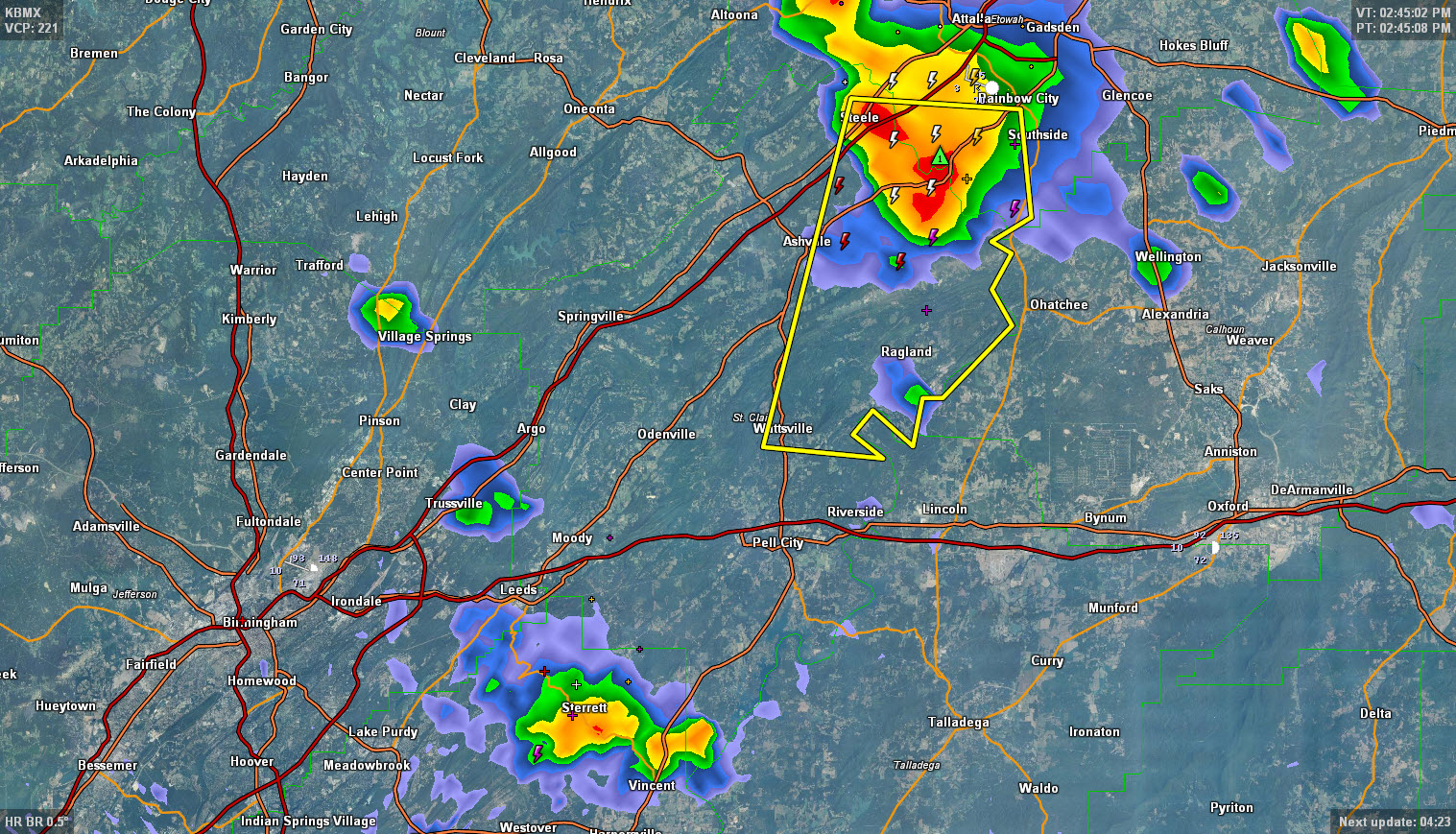
THE NATIONAL WEATHER SERVICE IN BIRMINGHAM HAS ISSUED A
* SEVERE THUNDERSTORM WARNING FOR…
EXTREME SOUTH CENTRAL ETOWAH COUNTY IN NORTHEAST ALABAMA…
NORTHEASTERN ST. CLAIR COUNTY IN ALABAMA…
* UNTIL 330 PM CDT
* AT 242 PM CDT…THE NATIONAL WEATHER SERVICE INDICATED A SEVERE
THUNDERSTORM CAPABLE OF PRODUCING QUARTER SIZE HAIL…AND DAMAGING
WINDS IN EXCESS OF 60 MPH. THIS STORM WAS LOCATED 5 MILES
SOUTHEAST OF STEELE…OR 7 MILES SOUTHWEST OF RAINBOW CITY…AND
MOVING SOUTH AT 15 MPH.
* LOCATIONS IMPACTED INCLUDE…
RAGLAND…NEELY HENRY DAM AND WATTSVILLE.
56
Category: Alabama's Weather
About the Author (Author Profile)
Subscribe
If you enjoyed this article, subscribe to receive more just like it.


