Disturbance Headed Our Way
Areas across the northern third of the state started off rather cloudy this morning, while southern areas enjoyed more sun early. This set up an interesting temperature story. Morning lows were coolest in areas that were clear overnight, which meant places like Troy and Evergreen were cooler than places like Muscle Shoals and Birmingham. Troy was one of the coolest places in the state with 40F. But areas that were clear overnight were warming faster this morning. Most everyone should be at least close to the 70s today, with a range between 69F in the Northwest and 74F in southern sections.
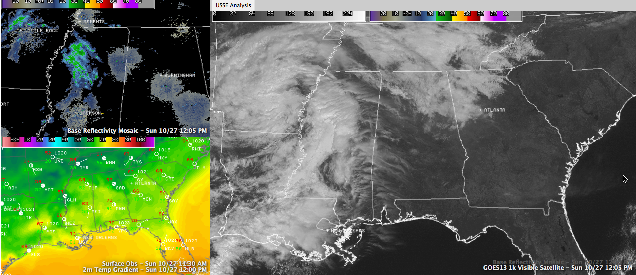
WATCHING THE RADAR: A few showers tried to work into Northwest Alabama this morning, but they ran out of steam as they encountered drier air. More showers were massed near the Mississippi River over the Delta area of western Mississippi, ahead of a vigorously spinning upper disturbance over Arkansas. Those showers and their associated clouds will affect parts of the area this afternoon. Rain chances will be low and amounts will be equally low.
OVERNIGHT SHOWERS: Additional showers will form overnight to our west and will move across the area as the disturbance tracks into northern Mississippi and across northern Alabama tonight. The NAM model has ramped up rain chances overnight, to about 70 percent for much of the area, so there is probably a better than even chance you will see overnight showers at your house if you live in Central Alabama.
MONDAY REPORT: There could be a few lingering showers early Monday, but they will move out and clouds should thin as we go through the day. This will allow temperatures to rise into the middle 70s with a few upper 70s.
Category: Alabama's Weather
About the Author (Author Profile)
Bill Murray is the President of The Weather Factory. He is the site's official weather historian and a weekend forecaster. He also anchors the site's severe weather coverage. Bill Murray is the proud holder of National Weather Association Digital Seal #0001 @wxhistorianSubscribe
If you enjoyed this article, subscribe to receive more just like it.


