A Little Very Light Rain
Click image to enlarge.
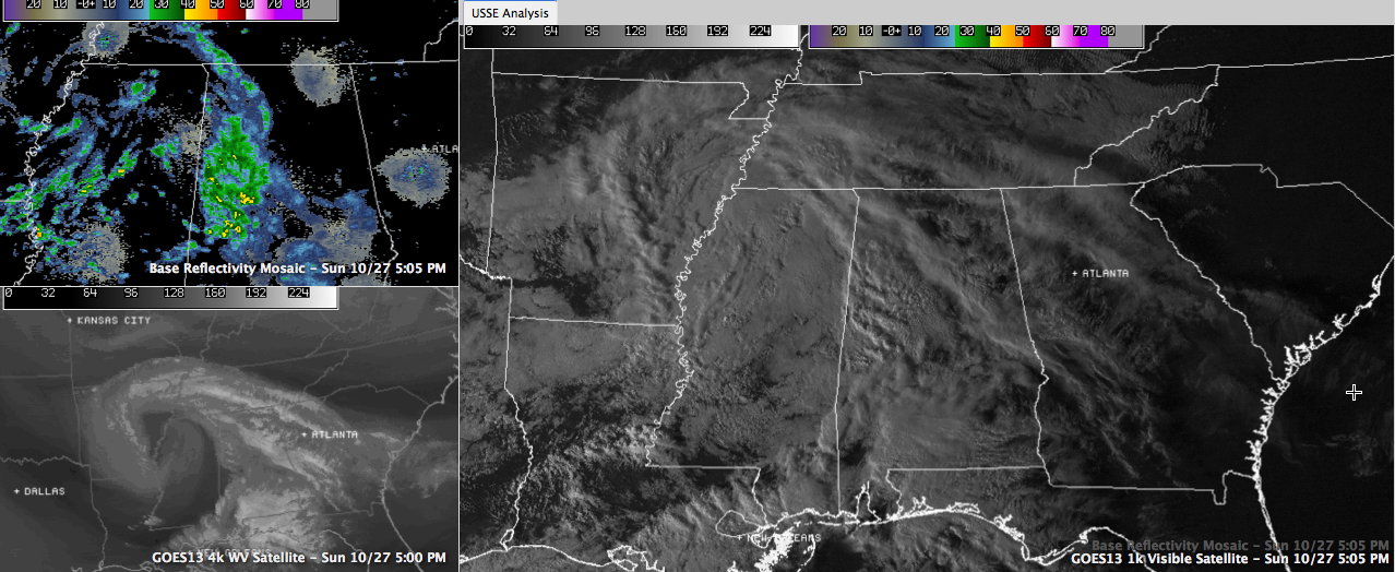
An interesting feature is spreading very light showers across western Alabama at this hour.
On water vapor satellite imagery (lower left panel of image above), it shows up clearly as a small upper level low approaching the Mississippi River south of Memphis.
The larger panel of the image shows the visible satellite, which indicates the
Showers have been filling in over the past couple of hours south of the low over the Mississippi Delta counties of western Mississippi. See the radar composite in the top left panel of the image?
Ahead of that, the leading edge of an area of moisture that exists in the mid levels from about 10,000 to about 10,000 feet above the ground is spreading eastward and running up and over the high pressure to the east of us. Not all of the echoes are precipitation that has been reaching the ground, but the echoes are getting stronger and the light rainfall seems to be increasing.
There has been some light rain at Tuscaloosa in the past hour. A trace was reported. It rained at Columbus MS earlier, but the rain was not measurable.
These light showers will continue to spread eastward across Central Alabama over the next few hours. You may have to turn on the windshield wipers for a few minutes, but you probably won’t get measurable rain (0.01″ or more).
More light showers are possible overnight until the disturbance moves east of us early tomorrow.
Category: Alabama's Weather
About the Author (Author Profile)
Bill Murray is the President of The Weather Factory. He is the site's official weather historian and a weekend forecaster. He also anchors the site's severe weather coverage. Bill Murray is the proud holder of National Weather Association Digital Seal #0001 @wxhistorianSubscribe
If you enjoyed this article, subscribe to receive more just like it.


