

Rain Overspreading Alabama
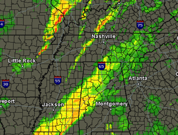
Light to moderate rain will be what most of us will see the next several hours. It is making for some wet trick-or-treating across central Alabama. The rain is now making it into the Birmingham metro and will be impacting eastern portions of the state over the next couple of hours. The heavier rain is southwest of central Alabama and this more intense activity will more than likely stay south of the area.
We are seeing the rain taper off in northwest Alabama as the back edge of the main rain shield continues east. Until the front passes us by, which will be during the early morning hours, there will still be a chance for additional showers and storms to develop. We see some evidence of this occurring across western Tennessee and northern Mississippi as a thin line of convection has developed. Farther to the northwest, even more storms have developed across northern Arkansas, and these storms are actually along the front.
These additional storms could build south along and out ahead of the front, and that will be what we are watching for during the overnight hours. There could be a few strong storms with gusty winds overnight, but severe weather is not expected as the air mass over Alabama is very stable. Additionally, the best dynamics with this system are over the Ohio River Valley.
Category: Alabama's Weather
About the Author (Author Profile)
Macon, Georgia Television Chief Meteorologist, Birmingham native, and long time Contributor on AlabamaWX. Stormchaser. I did not choose Weather, it chose Me. College Football Fanatic. @Ryan_StinnetSubscribe
If you enjoyed this article, subscribe to receive more just like it.


