

Egads, the CADS
Click image to enlarge.
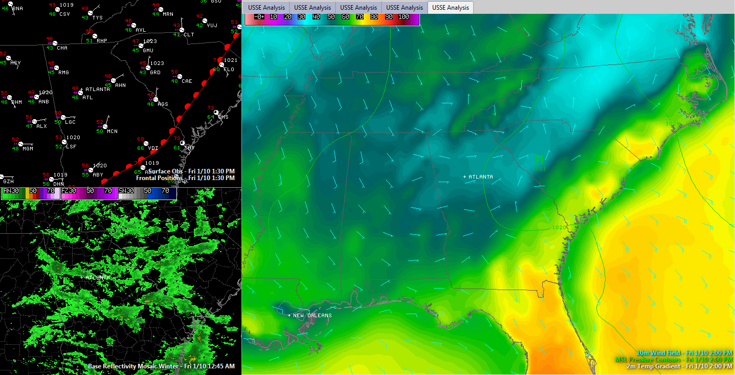
Today’s clouds, mist and cool temperatures have been compliments of a fascinating pattern called a cold air damming setup (CADS). In this scenario, high pressure centered over the Mid-Atlantic states pushes cold air back up against the Appalachian Mountains, which act as a dam. The colder, denser air flows back southwest across the Piedmont of South Carolina and northern Georgia. In fact, it doesn’t stop until it runs out of mountains in its way, which if you have driven up I-20, you know is somewhere around Cook Springs.
While we enjoyed a miserable day around here, the temperature contrast in states to the east was quite impressive. Across the Palmetto State at 1 p.m., it was a delightful 72F in the historic port city of Charleston where people were strolling The Battery like It was April, while 150 miles to the northwest, people in Greenwood SC were bundled up against a chilly light rain. In Georgia, people traveling south on I-75 stopped for lunch in Macon, putting on their coats at 52F, but were promptly shedding them by Valdosta, less than two hours later, where it was 73F.
The high pushed east during the day, relaxing the easterly flow.
One more interesting thing a CAD event like this one is that the airmass that invades the area from the east is very shallow. While the low level winds are out of the east or northeast, by the time you get to even 2,500 feet, the winds are out of the southwest, and they are transporting moisture northeastward out of the Gulf of Mexico. As this moisture rides up and over the colder, denser air, it of course condenses making more clouds and some heavier rain that fell across much of Georgia and the Carolinas. Augusta did manage to pick up a third of inch of rain.
The upper level trough responsible for the southwesterly winds aloft is swinging into Dallas this evening. It will continue its eastward trek overnight, pushing an increasing area of rain into Alabama later tonight. There could be some thunder mixed in, but the storms will be weaklings, so no severe weather threat.
Temperatures should come up overnight, moderating into the lower 60s by morning.
The rain will end quickly from west to east Sunday morning, with all of the rain out of the state by 3 p.m. Expect some sun within a few hours of the front’s passage. Rainfall amounts should average between one half and one inch.
The rain will
Category: Alabama's Weather
About the Author (Author Profile)
Bill Murray is the President of The Weather Factory. He is the site's official weather historian and a weekend forecaster. He also anchors the site's severe weather coverage. Bill Murray is the proud holder of National Weather Association Digital Seal #0001 @wxhistorianSubscribe
If you enjoyed this article, subscribe to receive more just like it.


