Overall Improvement in the Dry Conditions
We noted earlier this week in the January Rainfall Totals map, that much of Alabama had received a few inches of precip during the month of January. However, the amplified pattern over the country had essentially shut off our main moisture source for Alabama, the Gulf of Mexico. That pattern and lack of moisture return from the south caused much of Alabama to have rainfall deficits of 1.5-4 inches during the month of January. That of course has caused drier conditions across the state, and actually enhanced the threat of wildfires in areas.
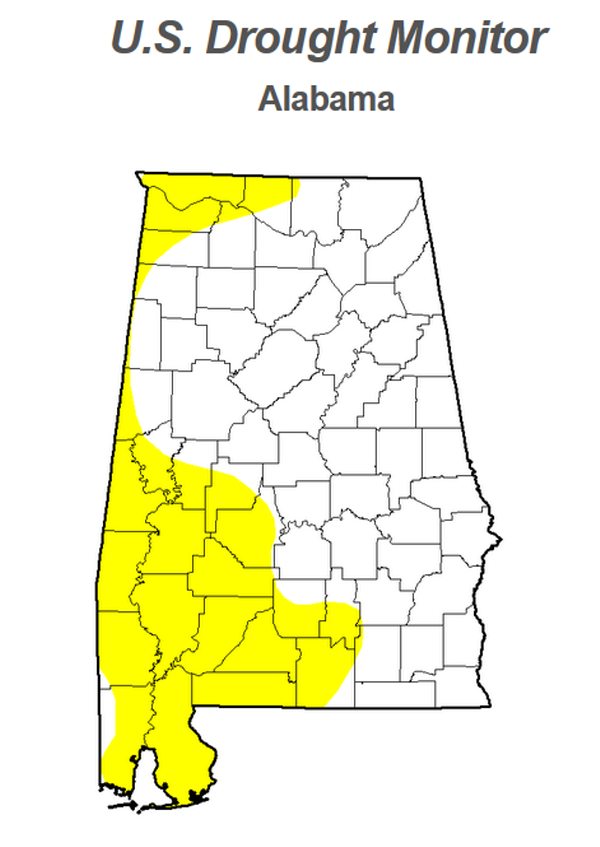
As take a look at the U.S. Drought Monitor for this week, many parts of Alabama remain Abnormally Dry, but have improved over what was reported last week, that map is at the bottom of this post. A lot of that has to do with the rain we received Sunday and Tuesday nights.
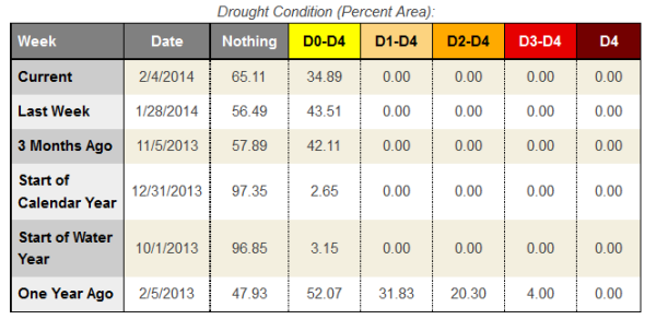
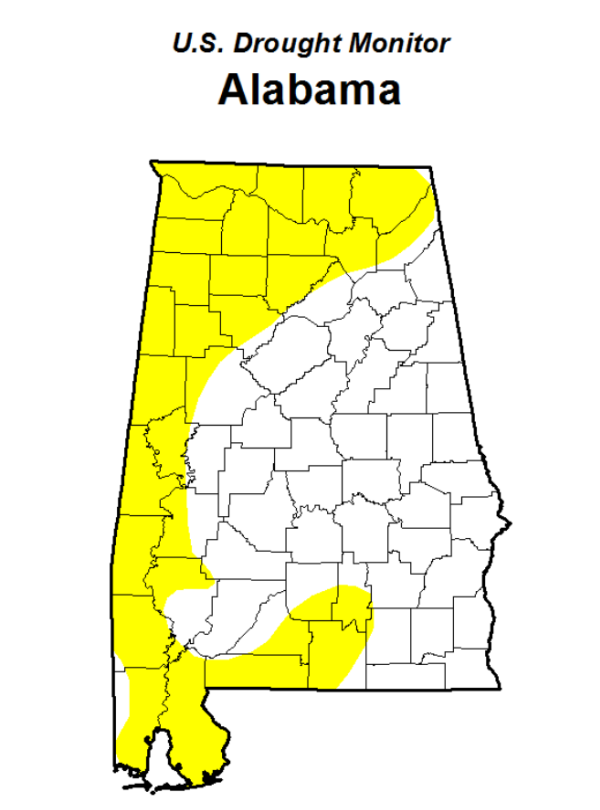
Here is last week’s monitor map. We do see that most of the Abnormally Dry conditions that were over northern portions of the state, have since improved. The chart above confirms the improvement and shows the differences from this week to last.
Category: Alabama's Weather
About the Author (Author Profile)
Macon, Georgia Television Chief Meteorologist, Birmingham native, and long time Contributor on AlabamaWX. Stormchaser. I did not choose Weather, it chose Me. College Football Fanatic. @Ryan_StinnetSubscribe
If you enjoyed this article, subscribe to receive more just like it.


