First Period Done, Second and Third Periods Will be Interesting
Hockey games feature three periods. This event in Alabama weather is like a hockey game.
The first period played out about as expected across Alabama with a significant snow across North Alabama and temperatures that were able to cool to freezing or just below down to I-20 causing glazing on exposed surface and a nice adornment for the trees without bringing down any power lines. Roads have been good in the I-20 corridor though with no travel problems reported.
Now we are in the intermission waiting for the second period, which starts tonight. Already radars to the west are seeing increasing precipitation across southern Oklahoma, northern Texas and Northwest Louisiana ahead of the next wave in an active southern jet stream.
The morning run of the NAM treats this entirely as a rain event tonight with the exception of the northwest corner of the state, where it predicts freezing rain. Most of the state experiences only a cold rain overnight.
But we are not buying this as the solution to model our forecast for the next 36-48 hours. That is because it does not seem to be taking the wedge effects into account at all, nor the really cold temperature that are in place over North Alabama right now in the snow area.
The GFS seems to have a better handle on the situation. And it even understates the potential for freezing rain tonight in North Alabama tonight. Let’s go through time using the GFS precip type graphics to explain the story.
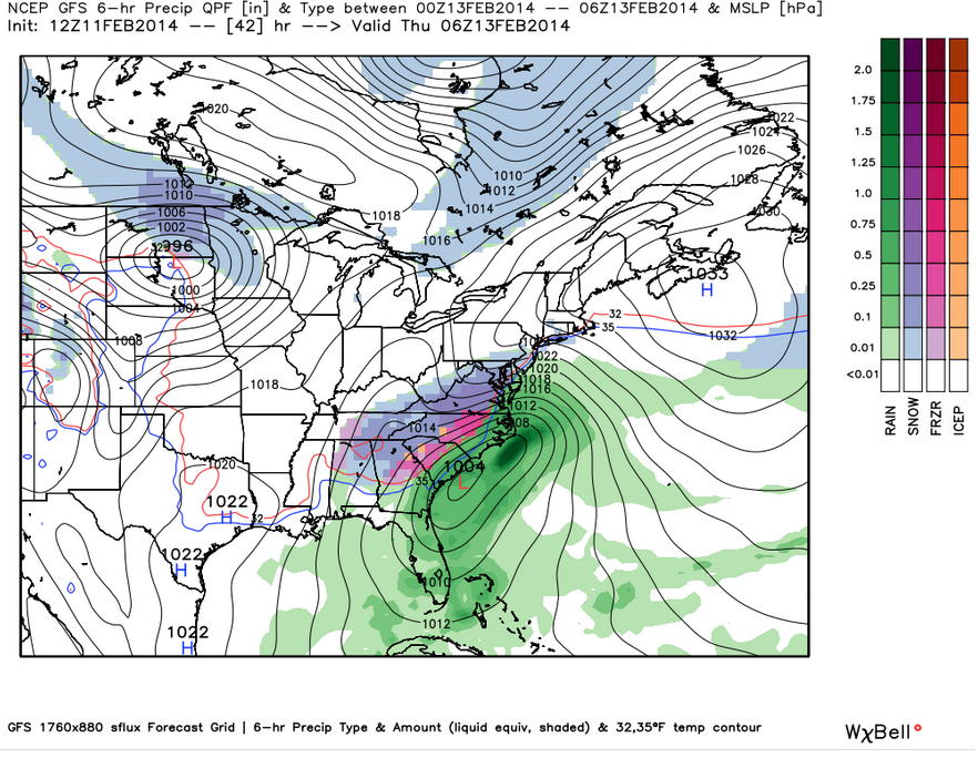
Here is the evening period from 6 p.m. to midnight.
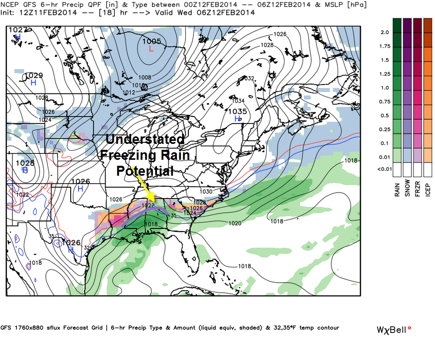
It shows freezing rain over northern Louisiana into northern Mississippi. But the freezing line may well be south of where the model thinks and this will result in more widespread freezing rain from the Mississippi Delta into North Alabama. On this graphic, the freezing line is shown as a curved purple line.
This means freezing rain will be a problem tonight in the areas that saw snowfall today from Lamar and Marion Counties eastward through Cullman and Blount into Etowah, Cherokee and perhaps even Calhoun and Cleburne Counties.
This trend continues though the overnight hours with icing continuing for places like Hamilton, Cullman, Guntersville, Gadsden, Centre and perhaps even Anniston.
For areas to the south, including Tuscaloosa, Anniston and Birmingham, it will be a cold rain, although we can’t rule out it being colder in spots and having some freezing rain develop,
Here is the map for 6 a.m.:
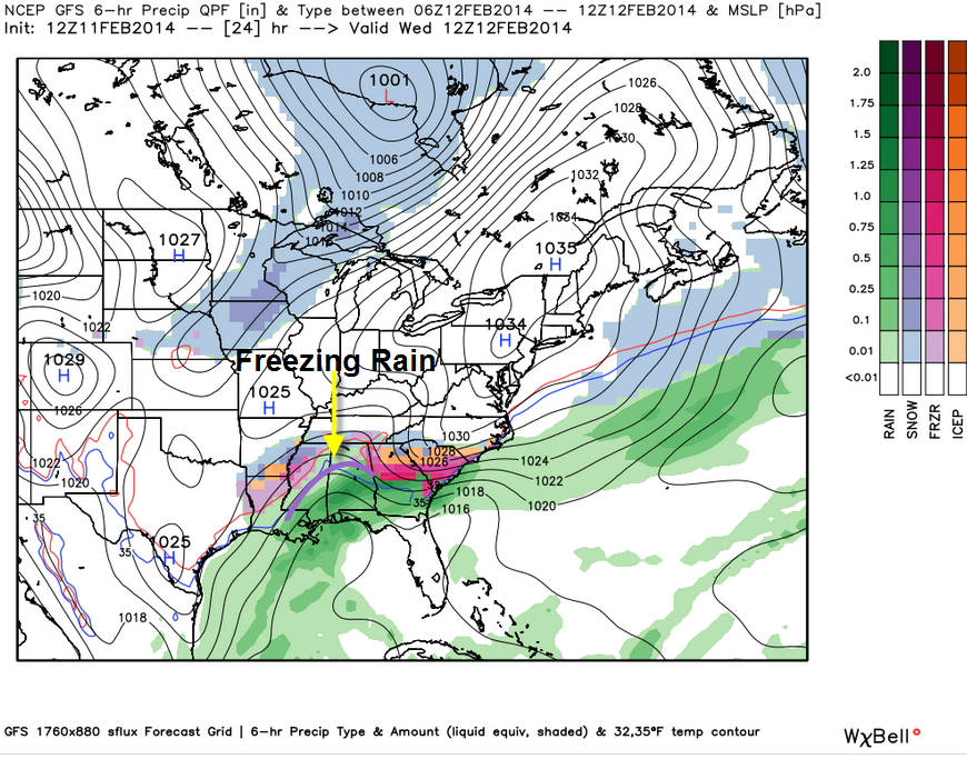
The freezing rain threat will continue into the morning hours from Calhoun and Cleburne Counties northward into Cherokee and Etowah Counties> Notice the snow starting to develop over the Tennessee Valley though. As colder air spreads southward on the back side of the Gulf low, precipitation will change to snow from north to south. This will represent the puck dropping for the third period.
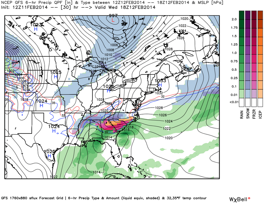
That changeover should occur in the Birmingham area by early afternoon and by nightfall, snow will have spread as far south as I-20.
The snow could fall as far south as a line from Eutaw to Prattville to Lafayette before it moves into Georgia during the overnight hours.
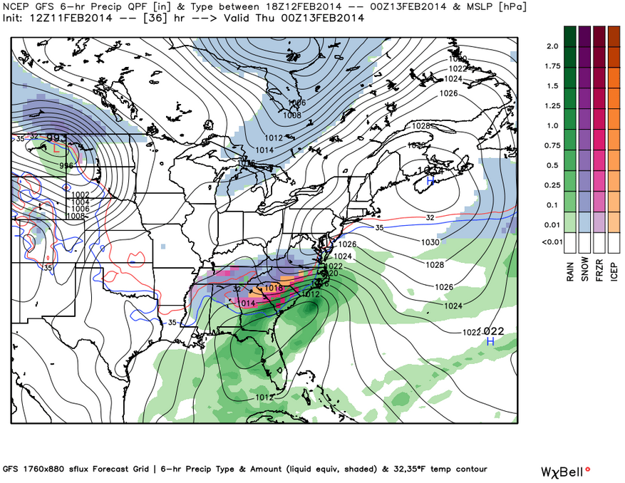
This will mean significant icing tonight for North and Northeast Alabama as well as the potential for an accumulating snow tomorrow afternoon and tomorrow night for much of the northern half of the state. We will have more on the impacts and timing shortly. Stay tuned.
For now the NWS has made the following changes to their advisories:
BIRMINGHAM
…Winter Storm Warning canceled for Pickens and Tuscaloosa.
…Winter Weather Advisory canceled for Bibb, Greene, Hale and Sumter.
…Winter Weather Advisory continues for Clay, Randolph, Shelby, Talladega through midnight Wednesday night.
…Winter Storm Warning continues for Blount, Calhoun, Cherokee, Cleburne, Etowah, Fayette, Jefferson, Lamar, Marion, St. Clair, Walker, Winston through midnight Wednesday night.
HUNTSVILLE (ALABAMA COUNTIES ONLY)
….Winter Storm Warning continues for Cullman, De Kalb, Jackson, Lawrence, Marshall, Morgan til Thursday morning.
HUN continues Winter Storm Warning valid at Feb 12, 6:00 AM CST for Cullman, De Kalb, Jackson, Lawrence, Marshall, Morgan …Winter Weather Advisory canceled for Colbert, Franklin, Lauderdale, Limestone and Madison Counties.
…Winter Storm Warning starting Wednesday morning at 6 a.m. for Colbert, Franklin, Lauderdale, Limestone and Madison Counties running until 6 a.m. Thursday.
Category: Alabama's Weather, Winter Weather
About the Author (Author Profile)
Bill Murray is the President of The Weather Factory. He is the site's official weather historian and a weekend forecaster. He also anchors the site's severe weather coverage. Bill Murray is the proud holder of National Weather Association Digital Seal #0001 @wxhistorianSubscribe
If you enjoyed this article, subscribe to receive more just like it.


