

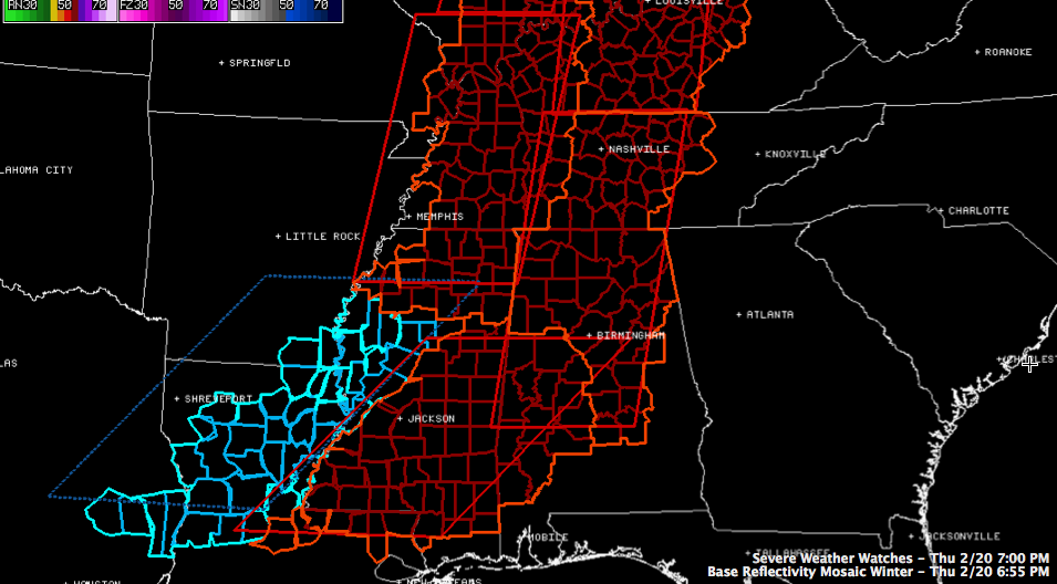
New Tornado Watch Until 3 a.m. For Much of the Rest of Central Alabama

The NWS has issued a new Tornado Watch for more counties in Central Alabama until 3 a.m. It includes the following counties: Autauga, Blount, Calhoun, Cherokee, Chilton, Clay, Coosa, Elmore, Etowah, Fayette, Jefferson, Lamar, Lowndes, Marion, Montgomery, Shelby, St. Clair, Talladega, Walker and Winston Counties til 3:00 AM CST.
This is in addition to the Tornado Watch for Bibb, Dallas, Greene, Hale, Marengo, Perry, Pickens, Sumter and Tuscaloosa Counties til 1 a.m.
CURRENT WATCHES
STORMY WEATHER
The air across Central Alabama has a very stormy feel to it this evening. With good reason: a very dynamic system is beginning to impact the state. Our surface low is nearing Madison WI tonight, and has deepened rapidly to 986 millibars. Winds are strong at the surface from the low all the way southward to the Gulf Coast.
UP at about 18,000 feet, an upper disturbance is rotating eastward across Kansas. Strong winds of 120-140 mph have developed along the leading edge of this disturbance. This will help the lift in the atmosphere.
A strong low level jet is developing over Louisiana and western Mississippi and this jet will move across our area later tonight, and this will dramatically increase low level wind shear.
You may have noticed that dewpoints dropped during the day. This is because the airmass over Alabama turned over with all of the heating, like the record high of 81F that occurred at Tuscaloosa. As a result of this mixing of the atmosphere, drier air aloft was mixed down to the surface. This create a situation that is unfavorable for tornadoes in Alabama. It is characterized by relatively high LCLs (lifted condensation levels). But that situation is going to change this evening and moist air continues to be transported north and we lose all of the mixing.
Instability values are decent or a late winter system with CAPE values of up to 1000 j/kg within about 75 miles either side of I-59 and 1000-2000 j/kg over southwestern sections of the state.
The main line of storms is now within an hour of Northwest Alabama.
Additional storms over Louisiana and southern Mississippi will find increasingly favorable conditions over the next hour or so and will become severe, pushing northeastward toward Alabama.
Conditions will come together to produce a significant severe weather threat for the tornado watch area, with the threat of damaging winds and a few tornadoes later this evening until the main line pushes through.
Category: Alabama's Weather, Severe Weather
About the Author (Author Profile)
Subscribe
If you enjoyed this article, subscribe to receive more just like it.


