

Very Dangerous Storm Approaching Columbia MS
A very dangerous potentially tornadic storm is in Marion County MS west southwest of Hattiesburg tonight.
It is going to be near Columbia MS shortly.
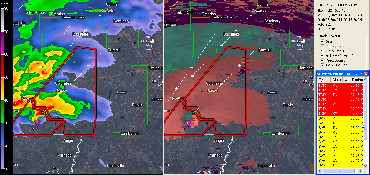
It has a well defined hook echo and velocity couplet. The NWS Jackson warns that its core is increasing as well.
This is an indication of how conditions are becoming more favorable for severe weather across Mississippi. These conditions will spread northeastward into Alabama as well overnight.
We urge all residents of Central Alabama to check their severe weather safety plans now and to have a source for receiving severe weather warnings even while they sleep.
Be ready to act immediately if tornado or severe thunderstorm warnings are issued for your location.
Please take all warnings, including severe thunderstorm warnings, seriously tonight. The potential is there for damaging winds and a few tornadoes tonight.
I am afraid that our 279 day tornado drought may come to an end tonight. We hope not, but chances are that it will.
Category: Alabama's Weather, Severe Weather
About the Author (Author Profile)
Bill Murray is the President of The Weather Factory. He is the site's official weather historian and a weekend forecaster. He also anchors the site's severe weather coverage. Bill Murray is the proud holder of National Weather Association Digital Seal #0001 @wxhistorianSubscribe
If you enjoyed this article, subscribe to receive more just like it.


