Muggy Days With Sun And Storms
AT DAYBREAK: Nothing showing up on radar early this morning across the great state of Alabama; the sky is mostly cloudy with temperatures generally in the low 70s.
The overall synoptic scale hasn’t changed much… we have a hot upper ridge over the western half of the U.S., with a trough over the eastern states. And, another MCS (Mesoscale Convective System) is northwest of the state this morning.
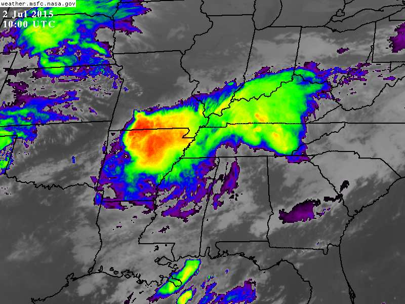
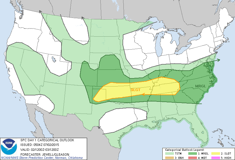
New showers and storms will form later today on the outflow of the activity north of Memphis, and like yesterday, heavier thunderstorms will be capable of producing very frequent lightning, gusty winds, and heavy rain. Looks like we had a wet microburst near Calera early last night producing wind damage and knocking out power. SPC has the standard “slight risk” of severe weather up today and tonight for far North Alabama, with a “marginal risk” down into the central counties of the state.
The high today will be in the mid to upper 80s.
FOURTH OF JULY WEEKEND: Not much change for tomorrow, Saturday, and Sunday. Each day will feature a mix of sun and clouds with the risk of a few passing showers and thunderstorms. No way to give specific start/stop times of the rain… the majority of the storms will come during the afternoon and evening hours, but with a northwest flow aloft pattern, we sure can’t rule out a late night or morning shower.
On the positive side, there will be some very nice breaks in the rain, the sun will be out at times, and heat levels won’t be bad at all for July, with highs holding in the mid to upper 80s.
NEXT WEEK: We expect a very slow trend toward increasing amounts of sunshine, hotter afternoons, and fewer showers and thunderstorms as upper ridging returns to the Deep South. A good chance we reach the low 90s by mid-week. See the Weather Xtreme video for maps, graphics, and more details.
AT THE BEACH: About 7 to 9 hours of sunshine daily for the Central Gulf Coast through the holiday weekend from Panama City Beach west to Gulf Shores, with the standard risk of a passing storm from time to time. Highs on the immediate coast will remain in the mid to upper 80s, with low 90s inland. Sea water temperatures remain in the low to mid 80s.
TROPICS: A vast amount of dry air continues to cover the Atlantic basin, and tropical storm formation is not expected over the next five days.
WEATHER BRAINS: Don’t forget you can listen to our weekly 90 minute netcast anytime on the web, or on iTunes. This is the show all about weather featuring many familiar voices, including our meteorologists here at ABC 33/40.
CONNECT: You can find me on all of the major social networks…
Facebook
Twitter
Google Plus
Instagram
Look for the next Weather Xtreme video here by 4:00 this afternoon…. enjoy the day!
Category: Alabama's Weather
About the Author (Author Profile)
James Spann is one of the most recognized and trusted television meteorologists in the industry. He holds the AMS CCM designation and television seals from the AMS and NWA. He is a past winner of the Broadcast Meteorologist of the Year from both professional organizations.Subscribe
If you enjoyed this article, subscribe to receive more just like it.


