

Small Risk Of A Shower Tomorrow
BLUE SKY AND SUNSHINE: Hard to find a decent cloud in the Alabama sky today; temperatures are mostly in the low 60s, a little above average for December 8 (Birmingham’s average high today is 58). The sky will stay mostly fair tonight; not as cold as last night with most communities holding above 40 degrees.
TOMORROW: A short wave aloft will pass over North Alabama, and will push some clouds into the state. Moisture is very limited, but it could squeeze out a few isolated showers over the northern half of the state. Where showers do form, rain amounts will be light, and most spots won’t get a drop. The high tomorrow will be in the low 60s.
THURSDAY THROUGH SATURDAY: Afternoons will be very mild on these three days; we reach the upper 60s Thursday, and low 70s are likely Friday and Saturday. Moisture levels will slowly rise, and a few isolated showers are not out of the question Friday and Saturday, but the chance of any one spot getting wet is so small, we won’t mention it in the forecast.
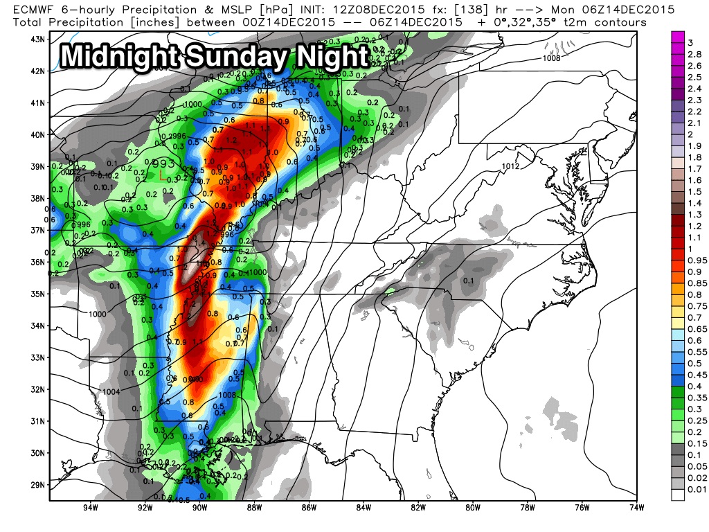
STORMY SUNDAY: A rather robust weather system will bring rain and storms into the state before the weekend is over. A deep upper trough will support a surface low, that will be close to Chicago by Sunday evening. The trailing cold front will bring a band of showers and strong thunderstorms into our state; those storms will be pretty healthy.
The low level jet (5,000 feet off the ground) will be over 60 knots, meaning strong straight line winds will be possible as the storms move through. High helicity values could bring the risk of a few small spin-up tornadoes within the line, but the limiting factor is the lack of good surface based instability and poor lapse rates.
Storm arrival times are problematic since models are still showing different solutions. The GFS (the American global model) shows the band of storms moving through during the day Sunday, while the ECMWF (European model) is much slower, suggesting the storms will arrive after midnight Sunday night into the pre-dawn hours Monday.
We should have better clarity in coming days as the event gets closer; stay tuned and watch these blog posts.
NEXT WEEK: Dry, cool weather is likely Monday and Tuesday with a high in the upper 50s, then another cold front will bring a chance of rain, and possibly a thunderstorm on Wednesday. See the Weather Xtreme video for maps, graphics, and more details.
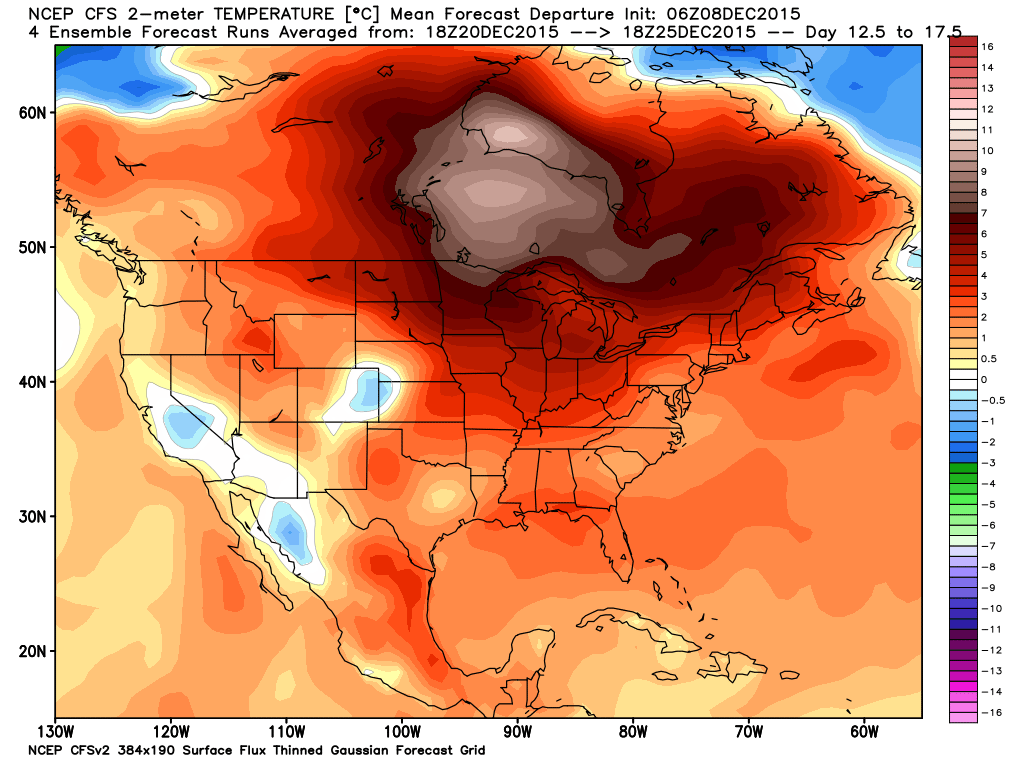
CHRISTMAS: The pattern continues to show relatively mild Pacific air over much of the continental U.S. late in the month… scroll down for my post about Christmas weather climatology in our state.
AT THE BEACH: Mostly sunny days, fair nights on the coast from Panama City over to Gulf Shores through Saturday… showers and storms return later in the weekend Sunday or Sunday night. See the complete Gulf Coast 7 Day Planner here. The Gulf Coast Beach Forecast is presented by Gulf Shores Plantation by Mandoki Hospitality Vacation Rentals. Escape to Gulf Shores Plantation where memories last a lifetime.
WEATHER BRAINS: Don’t forget you can listen to our weekly 90 minute netcast anytime on the web, or on iTunes. This is the show all about weather featuring many familiar voices, including our meteorologists here at ABC 33/40.
CONNECT: You can find me on all of the major social networks…
Facebook
Twitter
Google Plus
Instagram
Look for the next Weather Xtreme video here by 7:00 a.m. tomorrow…
Category: Alabama's Weather
About the Author (Author Profile)
James Spann is one of the most recognized and trusted television meteorologists in the industry. He holds the AMS CCM designation and television seals from the AMS and NWA. He is a past winner of the Broadcast Meteorologist of the Year from both professional organizations.Subscribe
If you enjoyed this article, subscribe to receive more just like it.


