Near Record Warmth Through Sunday
AT DAYBREAK: The sky is mostly cloudy cloudy early this morning, and temperatures are in the 60s, above average highs for December 11. Today will be mostly cloudy and unseasonably mild, and we will mention the chance of a few isolated showers as moisture levels rise. Temperatures each the low 70s this afternoon.
THE ALABAMA WEEKEND: Tomorrow will be partly sunny and warm; the high will be in the 72-75 degree range for most; the record high (for Birmingham) for December 12 is 78 degrees, set in 1971.
We believe the day Sunday will stay generally dry with only a small risk of an afternoon shower, and again we rise up in the low to mid 70s (Sunday’s record high is 79, set in 1931). South winds will pick up during the day, averaging 10-20 mph by afternoon. The sun will be out at times.
SUNDAY NIGHT SEVERE WEATHER? The good news is that the overall risk of severe weather Sunday night has lessened. In fact, SPC has dropped any formal severe weather threat for our state in their “Day Three” outlook, which covers Sunday night into early Monday morning.
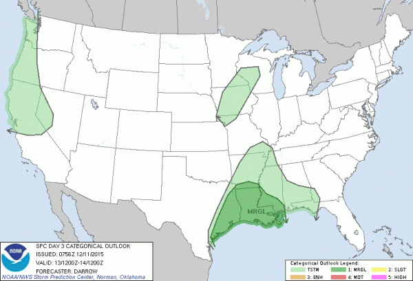
The lack of surface based instability is the main factor mitigating the risk; the air aloft for this kind of system is also pretty warm, meaning poor lapse rates. And, low level shear values have come down in modeling.
Still, we always have to watch systems like this for potential surprises… you all know: when it comes to thunderstorms, expect the unexpected.
But, for now, we will scale back and just mention a band of gusty showers passing through Sunday night. The main window for rain will come from about 7:00 p.m. Sunday through 4:00 a.m. Monday.
NEXT WEEK: Rain ends early Monday, and we will see gradual clearing later in the day with a high in the upper 50s. Tuesday will feature a good supply of sunshine with a high in the 60-65 degree range, and the latest model data hints Wednesday will be dry and pleasant as well. A batch of showers will move through late Wednesday night and Thursday, but no severe weather threat, and rain amounts won’t be too heavy. Then, cooler and drier air returns Friday. See the Weather Xtreme video for maps, graphics, and more details.
FOOTBALL WEATHER: Jacksonville State will host Charleston Southern tonight (7:00p CT kickoff) at Burgess Snow Field in the FCS quarterfinals; the sky will be mostly cloudy with temperatures falling from 65 at kickoff, to near 60 degrees by the final whistle. Very comfortable for December.
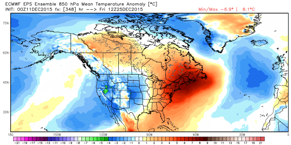
CHRISTMAS: Temperatures should be above average for the eastern third of the nation; the cold air will be out west. Probably close to average around here (that would mean highs in the 50s and lows in the 30s). Still too early for a specific forecast, of course)…
AT THE BEACH: Dry and mild weather today and tomorrow; showers and storms arrive Sunday night along the stretch from Gulf Shores over to Panama City Beach. See the complete Gulf Coast 7 Day Planner here. The Gulf Coast Beach Forecast is presented by Gulf Shores Plantation by Mandoki Hospitality Vacation Rentals. Escape to Gulf Shores Plantation where memories last a lifetime.
WEATHER BRAINS: Don’t forget you can listen to our weekly 90 minute netcast anytime on the web, or on iTunes. This is the show all about weather featuring many familiar voices, including our meteorologists here at ABC 33/40.
CONNECT: You can find me on all of the major social networks…
Facebook
Twitter
Google Plus
Instagram
I will be speaking to a pre-school group this morning in Attalla… look for the next Weather Xtreme video here by 4:00 this afternoon. Enjoy the day!
Category: Alabama's Weather
About the Author (Author Profile)
James Spann is one of the most recognized and trusted television meteorologists in the industry. He holds the AMS CCM designation and television seals from the AMS and NWA. He is a past winner of the Broadcast Meteorologist of the Year from both professional organizations.Subscribe
If you enjoyed this article, subscribe to receive more just like it.


