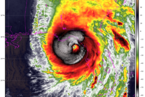
A Preview of WeatherBrains Episode 976: Mitch West and Mark Sudduth with a Look at Hurricane Helene
A very important show, looking at the scope of devastation from Hurricane Helene.
Owner of Tornado Talk. Radio broadcast meteorologist with The Storm Report. WeatherBrains Panelist. B.S. Meteorology from Penn State University.

A very important show, looking at the scope of devastation from Hurricane Helene.
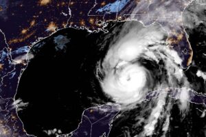
We are watching Helene make its approach toward the Northeastern Gulf Coast with a landfall of the center later today along the Big Bend area of Florida. Widespread, multiple impacts for millions of people along the coast and inland.
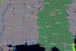
With Helene racing toward the Florida Big Bend Region, plenty of moisture will be pulled north and very heavy rain and the risk of flooding in place for parts of Alabama.
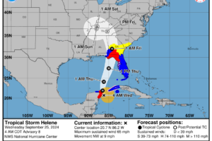
The NHC has issued their full 4am CDT Advisory. The Hurricane Hunters have been flying into the storm and have found lower pressure and increased winds.
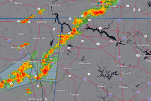
Monitoring closely the storms firing in Northwest Alabama and eastern Mississippi. They continue to move over the same areas and we may begin to see isolated flooding start to form. There is a severe storm at Smithville, MS.

Fun show last night! We had a great crew on from the NWS Indianapolis talking about the upcoming Central Indiana Severe Weather Symposium.
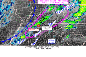
Scattered thunderstorms are starting to pop along a cold front. There is a marginal risk of severe storms across parts of Northern Alabama, with the main risk damaging wind gusts. In addition, we have chances for very heavy rain that could lead to isolated flooding.
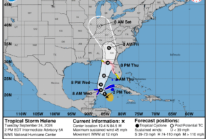
Helene is trying to get its act together over the NW Caribbean. Latest advisory shows the pressure is down another millibar. It is moving now more WNW.
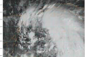
We have been waiting to see what the Hurricane Hunters have been observing and based on their reports and dropsonde data, we now have Tropical Storm Helene.
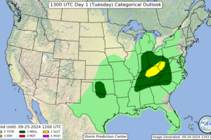
The Storm Prediction Center has placed parts of Northern Alabama under a marginal risk (level 1 out of 5) of severe thunderstorms today. This activity would form along a slow-moving cold front.
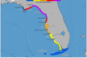
Quick update with this intermediate advisory from the NHC.
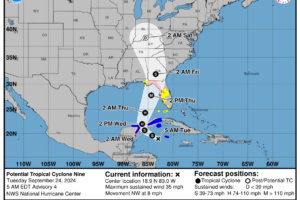
Good morning! It is time for another day in the tropics….and still no major answers in the latest NHC update. We have a disorganized system right now, but how long will that last? And when it does wrap up and begin to move over the Eastern Gulf, how strong will it become?
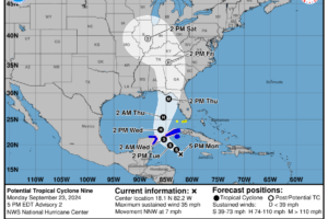
We have the thorough 4pm CDT update from the NHC and there have been some changes.

Join us at 8pm ET/7pm CT as we talk to a wonderful group of meteorologists from the NWS Indianapolis!
 Our long time friend, mentor, and charter Weather Factory member, J.B. Elliott, passed away on May 11, 2015. Click HERE to read James' tribute.
Notifications

