Alabama 811 | Know What's Below.

Archive for November, 2011

Cold Core Brings Some Snow To Alabama

Cold Core Brings Some Snow To Alabama

| November 28, 2011 @ 2:36 pm | 17 Replies

An all new edition of the ABC 33/40 Weather Xtreme video is available in the player on the right sidebar of the blog. You can subscribe to the Weather Xtreme video on iTunes by clicking here. THIS AFTERNOON: Temperatures are generally in the 35 to 42 degree range across North Alabama this afternoon, with light […]

Read More

Alabama Snow FAQ

Alabama Snow FAQ

| November 28, 2011 @ 1:22 pm | 12 Replies

Let’s see if we can answer all of the questions… *Is there a good chance of snow tonight? Yes, mainly if you are north of I-20. South of I-20 we might see a few snow flakes, but probably not many. *When will the snow fall? Best chance is from about 9:00 tonight through 9:00 tomorrow […]

Read More

Upper Air Look

Upper Air Look

| November 28, 2011 @ 12:02 pm | 26 Replies

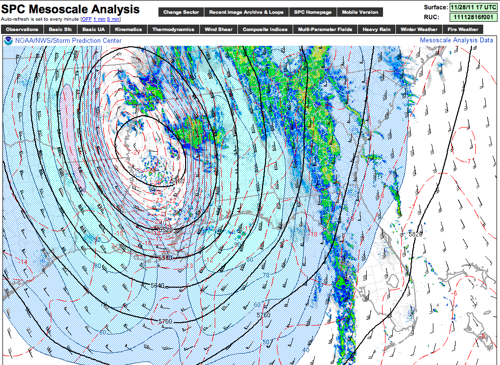
The cold core upper low is over Central Mississippi this hour… Temps at 500 mb (about 18,000 feet off the ground) are down to -27 degrees (C), or -16.6 degrees (F) at the center of the upper low… dynamic cooling will bring some of that downward in coming hours. Getting a handful of reports of […]

Read More

Late Morning Look

Late Morning Look

| November 28, 2011 @ 10:48 am | 6 Replies

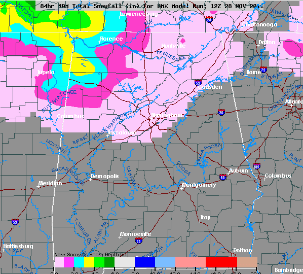
The new 12Z guidance matches our ongoing forecast nicely, so no need for any midday changes… below is the 12Z NAM snow accumulation projection… And, our forecast is below… Important points… *Best chance of snow is from about 9:00 p.m. tonight through 9:00 a.m. tomorrow *No travel issues are expected for Birmingham/Tuscaloosa/Anniston/Gadsden *The ground is […]

Read More

JB’s Journal–Can We Have Snow in November?

JB’s Journal–Can We Have Snow in November?

| November 28, 2011 @ 8:43 am | 8 Replies

ANSWER: You bet your boots we can! …or You can bet your bottom dollar we can! Let’s look back at one of the most dramatic examples. The date was November 24, 1950. A day or so earlier, thousands of football fans were in their short-sleeved shirts at Legion Field watching the annual Crippled Children’s Championship […]

Read More

New Data – Quick Peek

New Data – Quick Peek

| November 28, 2011 @ 8:07 am | Reply

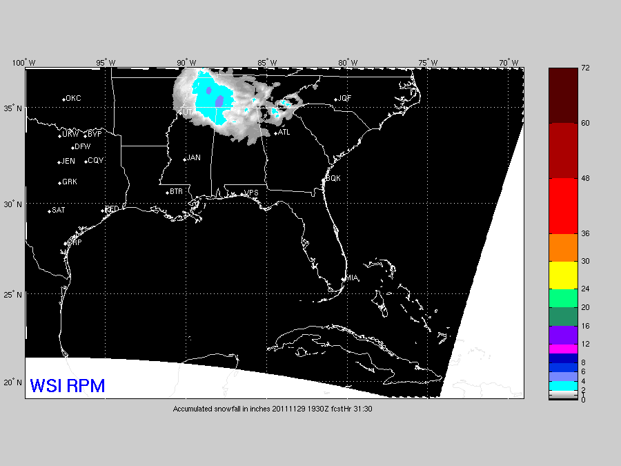
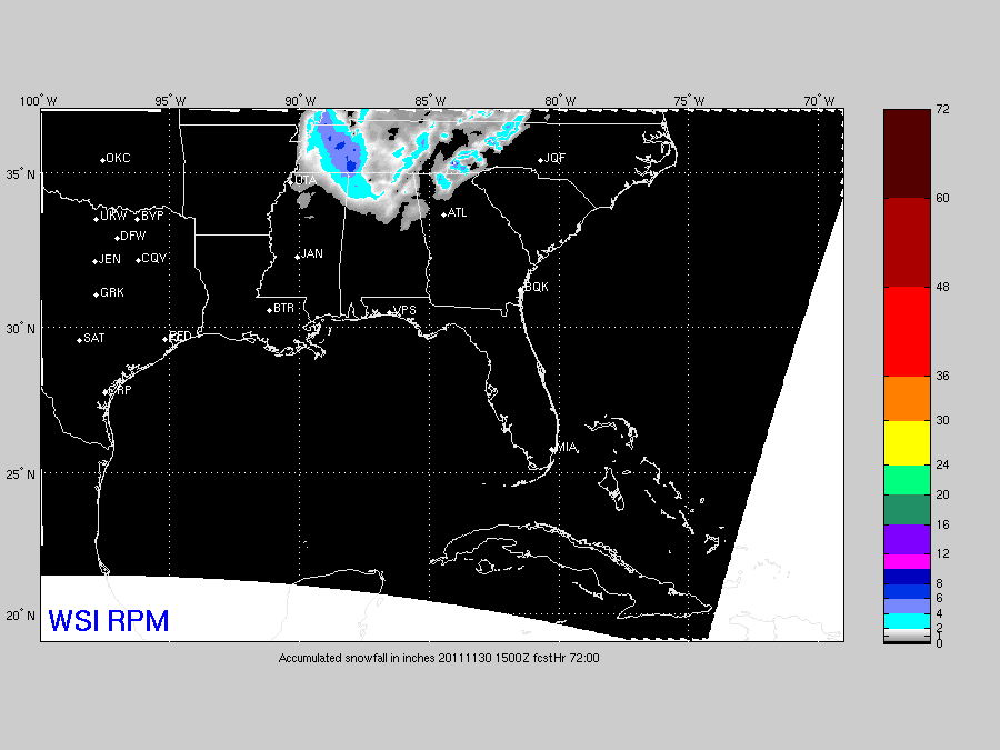
Here is the output of the 12Z RPM… confirms the idea the best chance of accumulating snow will be over Northwest Alabama, and adjacent parts of NE Mississippi and southern middle Tennessee… And, below is our ongoing snow accumulation forecast. Scroll down for the long discussion, and watch the Weather Xtreme video for details.

Read More

Cold And Wet With Some Snow

Cold And Wet With Some Snow

| November 28, 2011 @ 6:09 am | 20 Replies

An all new edition of the ABC 33/40 Weather Xtreme video is available in the player on the right sidebar of the blog. You can subscribe to the Weather Xtreme video on iTunes by clicking here. This is one of those mornings when it makes good sense to watch the Weather Xtreme video… often the […]

Read More

Winter Storm Watch – NE Mississippi

Winter Storm Watch – NE Mississippi

| November 28, 2011 @ 5:02 am | Reply

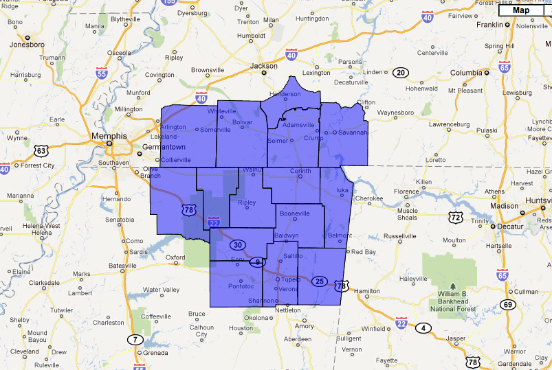
The watch matches the RPM show output nicely… WWUS44 KMEG 280936 WSWMEG URGENT – WINTER WEATHER MESSAGE NATIONAL WEATHER SERVICE MEMPHIS TN 336 AM CST MON NOV 28 2011 …EARLY SEASON WINTER STORM BECOMING MORE LIKELY ACROSS MUCH OF THE MIDSOUTH… .A POWERFUL UPPER LEVEL LOW WILL MOVE SOUTH OF THE AREA TODAY AND TONIGHT. […]

Read More

Snow analysis – 1019 pm

Snow analysis – 1019 pm

| November 27, 2011 @ 10:32 pm | 4 Replies

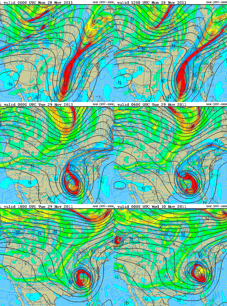
Above is a loop of 500 mb heights (lines) and vorticity (colors) over the next 36 hours.  You can see the upper low cutting off from the main flow, or forming a full circle, to our west tonight.  Satellite imagery indicates this may already be happening.  At the same time, much colder air is moving […]

Read More

Snow Potential

Snow Potential

| November 27, 2011 @ 5:50 pm | 9 Replies

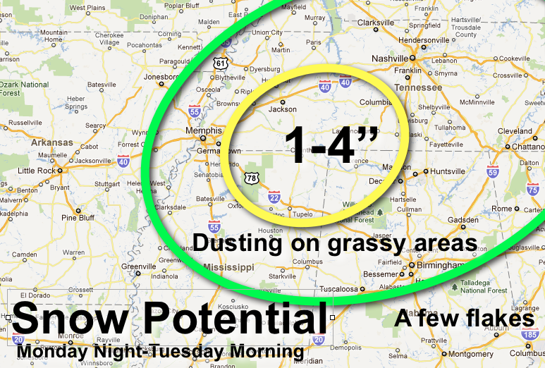
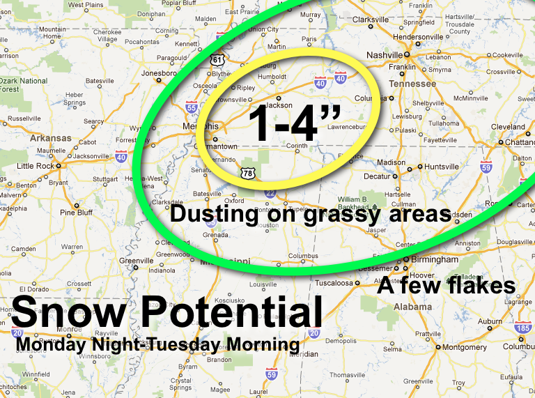
Here is the current thinking on snow accumulation potential for Monday night through Tuesday morning. Seems like the best combination of dynamic cooling and convective snow will be a little east of Memphis, and northwest of Muscle Shoals. Note are suggesting potential of 1 to 4 inches there, but even in that spot most of […]

Read More

Soaking Rain Continues

Soaking Rain Continues

| November 27, 2011 @ 4:28 pm | 5 Replies

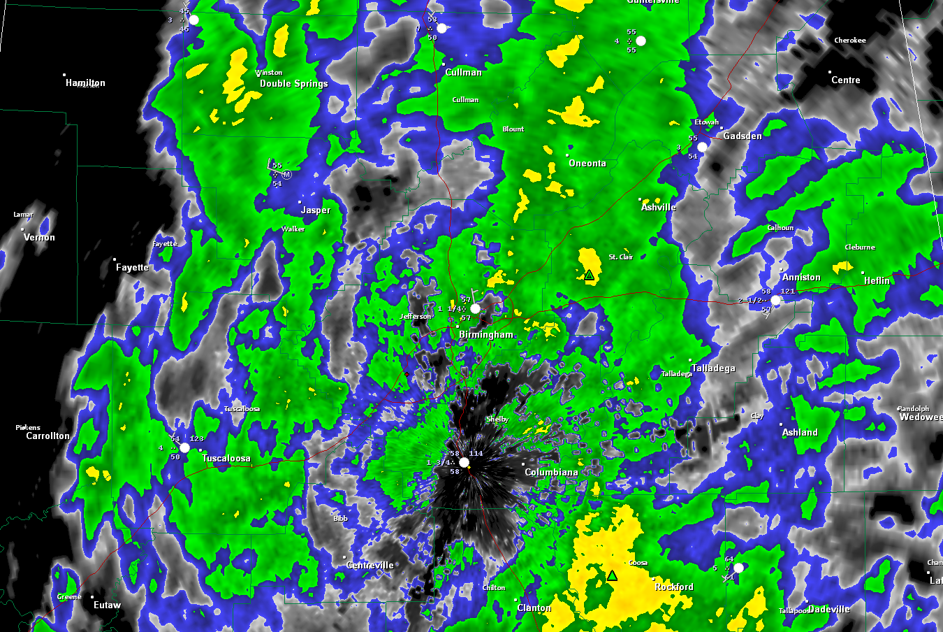
1.61 inches of rain at the Birmingham Airport through 4:07 this afternoon. It has been a slow soaking rain for many folks across North and Central Alabama, and it is going to continue for several more hours. Some of the heaviest rain is now over Coosa and Elmore Counties in East Alabama. It will lift […]

Read More

Latest RPM Snow Output

Latest RPM Snow Output

| November 27, 2011 @ 1:46 pm | 42 Replies

This is the 15Z run of the RPM… showing expected snow accumulation for the next 72 hours…. Not much change from earlier runs. And, this is the HPC probability of more than one inch of snow from 6pm CST Monday through 6pm CST Tuesday… Please note… *Any accumulation over North Alabama should be mainly over […]

Read More

Snow analysis

Snow analysis

| November 27, 2011 @ 11:47 am | 6 Replies

Wow, what a complicated forecast!  Two things are  pretty sure…it will be damp and occasionally precipitate from now through Tuesday morning…and it is about to get very cold.  It was in the 70s yesterday afternoon…same time tomorrow it will be in the 40s. The big question is whether snow will fall.  With an upper-level low […]

Read More

Rain and Colder – Snow?

Rain and Colder – Snow?

| November 27, 2011 @ 7:38 am | 10 Replies

The latest edition of the ABC 33/40 Weather Xtreme Video is available in the player below. You can subscribe to the Weather Xtreme Video on iTunes by clicking here. What an interesting forecast challenge we have ahead of us. For the moment, rain covers nearly all of Alabama from south to north with rainfall amounts […]

Read More