Alabama 811 | Know What's Below.

Archive for February 11th, 2014

More Reports

More Reports

| February 11, 2014 @ 5:48 am

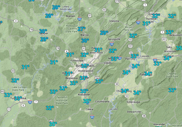
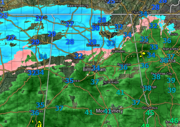
Now that temps have dropped to freezing in the Birmingham metro, there are a lot of reports of icing on elevated surfaces. Ice being reported on top of Red Mountain as well. Solid ice coating on parked cars throughout the county as freezing rain is being reported. Marion and Winston counties have accumulating snow and […]

Read More

Temperature Has Dropped to Freezing in Birmingham

Temperature Has Dropped to Freezing in Birmingham

| February 11, 2014 @ 5:08 am

Latest hourly observation from the Birmingham Airport now has the temperatures at 32 degrees with rain falling. Similar temps being reported across the metro area now. This will now lead to an enhancement of ice development. Throughout the early morning hours, there were reports of some light icing in the area on trees and elevated […]

Read More

A Wintry Mess this Morning

A Wintry Mess this Morning

| February 11, 2014 @ 4:51 am

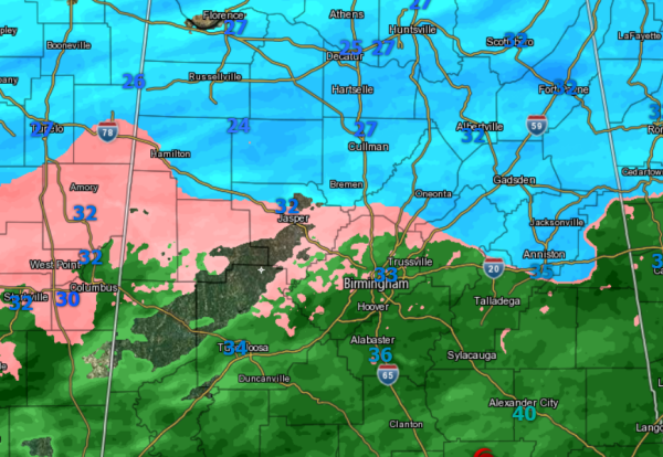
We are seeing those temps approach the freezing mark along Interstate 20. Temps of 32-33 are being reported and the 32 degree isotherm is now into Tuscaloosa, Jefferson, and St. Clair counties. That means we are now entering into a time of transition to frozen precip and icing conditions. From here on out, road and […]

Read More

Early Morning Update

Early Morning Update

| February 11, 2014 @ 3:06 am

The last few hours have been getting interesting across the area. The temperature have been slowly dropping in Central Alabama and we have seen an uptick in the precip rates. Accumulating snows ongoing across the Tennessee Valley from Florence to Huntsville. Between Birmingham and Huntsville, numerous reports of icing and slick spot on roadways along […]

Read More

Interesting Discussion from the SPC

Interesting Discussion from the SPC

| February 11, 2014 @ 1:58 am

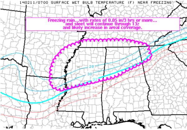
Regarding the threat for wintry precip across the Southeast this morning. Dry air continues to advect in from the north. This will cause the freezing line to slowly shift south the next few hours. Current freezing line is just to the north of Interstate 20 corridor as it sinks to the south, the rain currently […]

Read More

Some Storm Reports

Some Storm Reports

| February 11, 2014 @ 1:48 am

We are beginning to see a lot of issues developing as the snow, sleet, and freezing rain are increasing across the state. It is going to be a very long night and morning. Conditions the rest of the night are only going to get worse. Roads conditions are deteriorating rapidly in our northern counties. Do […]

Read More

Watching the Radar and Temps

Watching the Radar and Temps

| February 11, 2014 @ 1:12 am

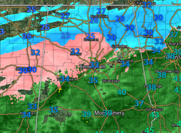
We are at the onset of a winter weather mess across the area. A variety of precip is falling across Alabama this morning. A look the radar, shows just how fine a line between liquid and fronzen precip we are seeing across the state. A lot of reports via social media are verifying what we […]

Read More