
Snow line based on Ping Data
Looks like the snow line based on Ping data is now near and north of a line from Sulligent to Jasper to Cullman to Centre as of the last 10 minutes

Looks like the snow line based on Ping data is now near and north of a line from Sulligent to Jasper to Cullman to Centre as of the last 10 minutes
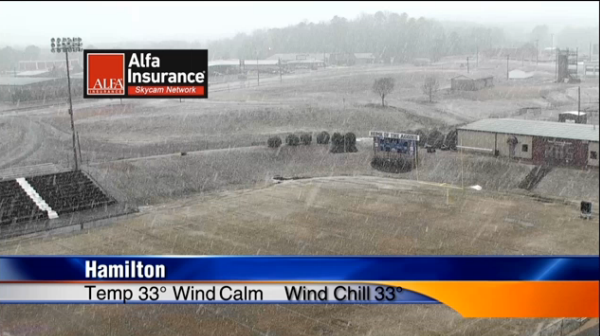
A quick look at our Hamilton skycam shows the snow is coming down rapidly. The transition is on from liquid to to frozen precip across the area and this transition zone is sinking south through the central portions of the state. It is taking less than an hour for the rain to transition through freezing […]

Rain is rapidly transitioning to frozen precip and snow across Central Alabama. We are seeing a majority of the snow reports across the northern counties, but that area of transition is dropping south, rapidly. Snow is falling in: Haleyville Fayette Cullman Hamilton Guin Carbon Hill Winfield Sleet being reported in: northern Tuscaloosa County Cullman West […]

THE FOLLOWING MESSAGE IS TRANSMITTED AT THE REQUEST OF THE ALABAMA EMERGENCY MANAGEMENT AGENCY IN CLEBURNE COUNTY. THE CLEBURNE COUNTY EMERGENCY MANAGEMENT AGENCY HAS ISSUED A COUNTY WIDE CURFEW FROM 6PM TONIGHT UNTIL 6AM TOMORROW MORNING. THE COUNTY IS REQUESTING THAT ALL NON-ESSENTIAL TRAVEL BE AVOIDED TO ENSURE THAT EMERGENCY ONLY TRAFFIC IS ALLOWED ON […]
The rain is turning over to sleet and snow across the area. Via social media, it starts raining, then becomes a freezing rain and sleet mixture, and finally turns into snow. The radar image has changed rapidly the last hour as blue and pink, which are snow and a wintry mix, are taking the place […]

Ping is an app used by the National Weather Service to monitor precip type …. you can help by downloading the app and reporting your precip type … https://www.nssl.noaa.gov/projects/ping/ … you can also see the current reports on a map here … https://www.nssl.noaa.gov/projects/ping/display/ you will need to zoom in to get northern Alabama but it should be […]

We continue to monitor conditions to our north as the transition will occur from north to south across much of the area this afternoon. From NWS Huntsville: Rain is slowly changing over to frozen precip across the Huntsville CWA, but not uniformly. Sleet/rain reports from Cairo, Madison, and Hunstville. Heavy sleet and snow falling in […]
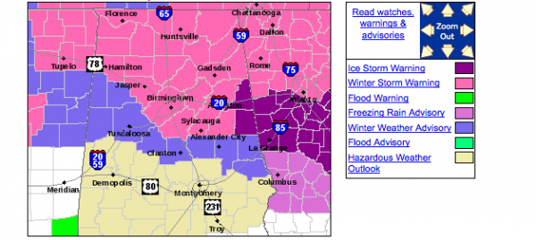
Important points for the rest of today and tonight… *Travel/driving conditions will deteriorate between now and 4 p.m. As colder air moves in from the east, and dynamic cooling brings colder air down from aloft. I would not advise travel past 4 p.m. if at all possible across North-Central Alabama. *Rain will change to snow […]

FROM NWS HUNTSVILLE …12:04 p.m. Snow/rain mix in Athens. …12:12 p.m. Snow covering the ground in Cloverdale in Lauderdale Co., south of Cherokee. …12:17 p.m. Moderate snow in Riverton in NW Colbert County. …12:23 p.m. Big flakes in Killen and at UNA. …12:29 p.m. Our old friend Jason Simpson posted a report of big flakes […]
It’s a dreary cold day across Central Alabama. Temperatures in the I-20 corridor range from 41F at Tuscaloosa to 37F at Birmingham, to 38F at Celera to 35F at Anniston. Weather stations in eastern Jefferson County and western St. Clair County, like Center Point, Leeds, moody and Odenville are showing 34-35F. Colder air continues to […]
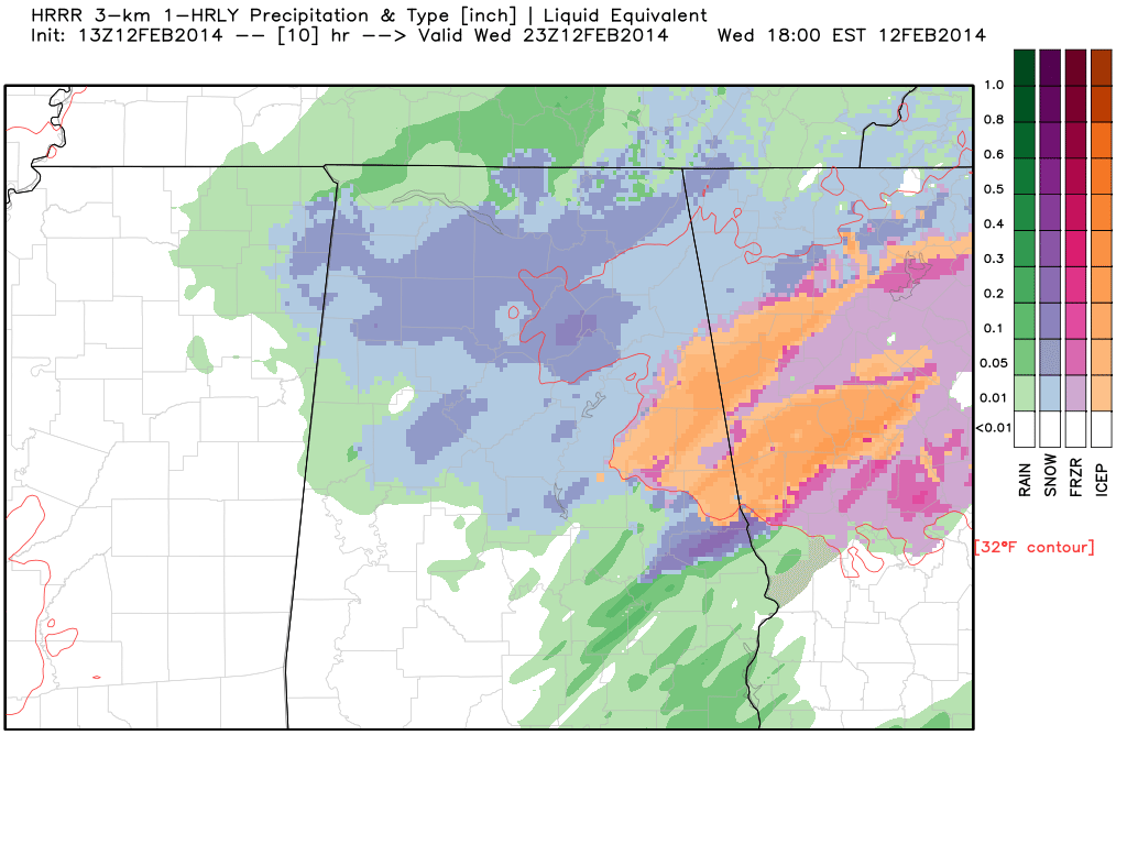
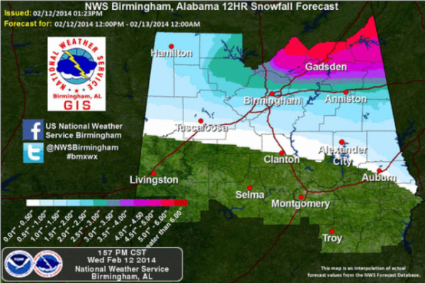
A few notes… we can clearly now see the deformation axis, which will coincide with the band of heavier snow, setting over Central MS… this rotate into North Alabama this afternoon and early tonight. Snow forecast amounts will need to be ramped up a bit in the winter storm warning area. New update out soon, […]
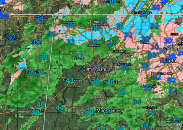
Quite the hodgepodge of weather across the state today. For most locations in Central Alabama, we continue to see light rain this midday. That remains right on track with forecasts and the overall thinking for today, as well as current model data. Our temps remain in the mid-30s, but as we head into the early […]
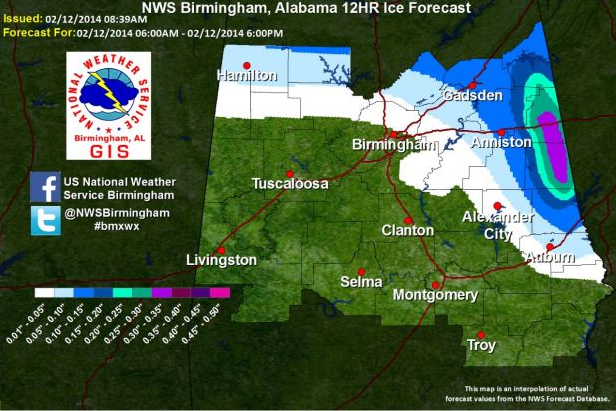
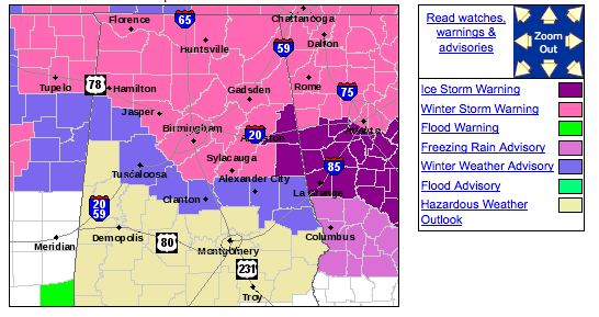
The NWS has dramatically upper their icing forecasts for the eastern Alabama counties of Cleburne and Randolph. They have issued an Ice Storm Warning for those two counties. An Ice Storm Warning is issued by the NWS Birmingham when ice accumulations are expected to be 1/4 inch of more. Large parts of those two counties […]
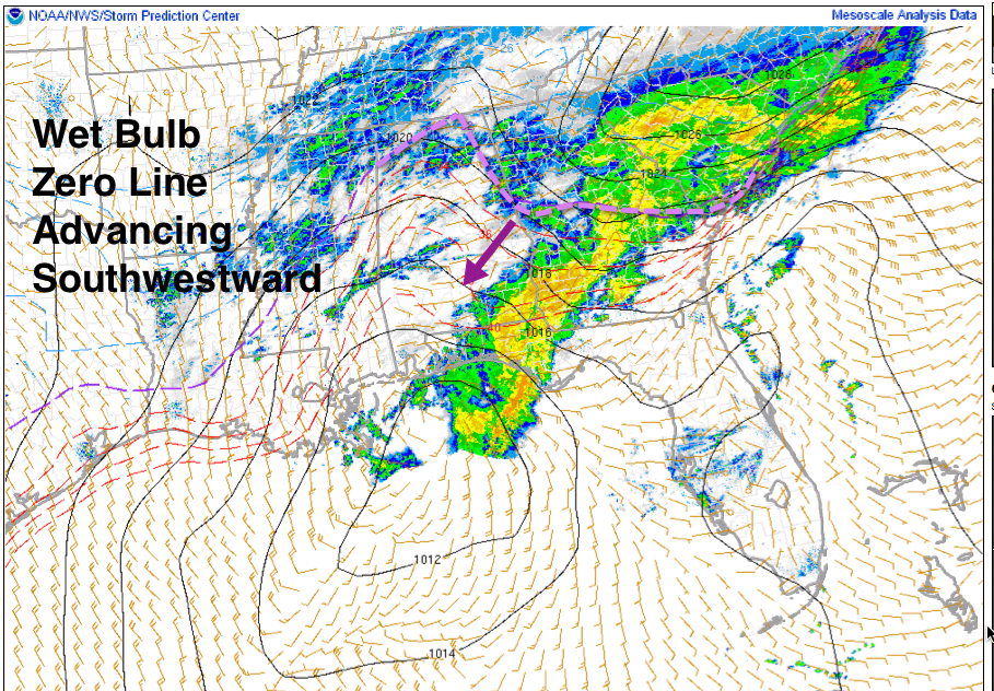
Freezing rain beginning to accumulate across Cleburne County. Reports of trees weighted down with ice and decks iced over at Muscadine in Cleburne County. Freezing rain is beginning to accumulate at Wedowee in Randolph County. Weather stations in the area indicate temperatures are hovering around 33F at places like Heflin and Saks and Barfield and […]